place

Forest Glade, Windsor

Neighbourhoods in Windsor, OntarioPages with non-numeric formatnum argumentsPlanned communities in Canada

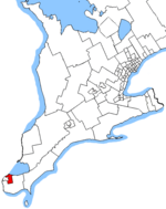
Forest Glade is an urban/suburban community located in the east end of Windsor, Ontario, Canada. Forest Glade forms a large section of the Windsor's border with Tecumseh, Ontario and is situated near the former town of Riverside, Ontario. It has an estimated population of 19,000 people. The physical borders of the community are Tecumseh Road East to the North, Banwell Road to the East, Lauzon Road to the West, and E.C. Row Expressway to the South. Forest Glade is accessed from three directions: West (off Lauzon Parkway), north (off Tecumseh Road East), and east (off Banwell Road). Nearby to a Tecumseh Road entrance is an entrance to the Ganatchio Trail, as well as a multitude of fast food restaurants, Tecumseh Mall, and several grocery stores. It has quick access to E.C. Row Expressway and is home to the easternmost sections of Transit Windsors 1C, 4, and 10 bus routes, providing excellent access to virtually anywhere in the city.

Excerpt from the Wikipedia article Forest Glade, Windsor (License: CC BY-SA 3.0, Authors).

Forest Glade, Windsor
Ridge Road, Windsor

Geographical coordinates (GPS) Address Nearby Places
placeShow on map

Wikipedia: Forest Glade, WindsorContinue reading on Wikipedia

Geographical coordinates (GPS)

Latitude Longitude
N 42.3092 ° E -82.9197 °
placeShow on map

Address

Ridge Road 9729
N8R 1J5 Windsor
Ontario, Canada
mapOpen on Google Maps

Share experience

Nearby Places

Ganatchio Trail

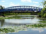
The Ganatchio Trail is the second bike trail built in Windsor, Ontario, Canada. Construction on the trail started upon the closure of Clairview Avenue. The trail extends over 5.3 km, and passes through several neighbourhoods, including Riverside and Little River, and serves Sandpoint Beach and Stop 26 Beach and Park. It was the second major trail constructed, after the Riverfront Bike Trail, with extensions east towards Tecumseh built in stages. The trail has a posted speed limit of 20 km/h. The Riverfront and the Ganatchio Trails are wide enough for two cycle lanes in each direction. The Ganatchio Trail and Little River Extension see a great deal of traffic in the summer, but nowhere near as much as the Riverfront Bike Trail. The Ganatchio Trail has commemorative signs all along it, and a special roundabout/traffic circle where the Ganatchio intersects with the Little River Extension, with a sign depicting its length, map location, and a sign for the Lions Club International and Rotary International, which funded the trail's construction in 1996. The Ganatchio Trail was built in 1971, incorporating much of Clairview Street, a narrow and rarely used residential street, into its route. The road was sealed off at some parts, and rerouted or truncated at other intersecting streets. The trail runs along Clairview in parts that were left intact, but many intersecting streets, such as Watson Avenue, were closed off, allowing only pedestrians and cyclists to go through. Clairview Avenue was also a boulevard from Watson to Genevieve Avenue. Its second carriageway was transformed into the bike trail, and a few parts were converted entirely into greenways with the trail. Clairview Street (with the Ganatchio Trail) also serves the Riverside Sportsman's Club (a fraternity similar to Lions Club International and Rotary International, which funded the construction of the bike trail with the RSC). The remainder of the trail (from Riverview Road to Tecumseh, and including its bridge over Little River) was built in 1979 and rehabilitated/upgraded in 1983. The trail's name comes from the Native American/First Nations name for Lake St. Clair.