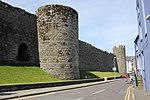
Lôn Eifion
Lôn Eifion is part of Lôn Las Cymru, the Welsh National Cycle Route, which is about 400 km (250 mi) long. Lôn Eifion is the section which runs for 20 km (12 mi) from Caernarfon to Bryncir along most of the former Caernarfon to Afon Wen line. This line was that of the Carnarvonshire Railway (later LNWR and London, Midland and Scottish Railway), and joined with the Cambrian Coast Line at Afon Wen. Running alongside for part of the way is the trackbed of the old Nantlle Tramway, along which horse-drawn trams carried slates from the quarries in the Nantlle Valley to the port at Caernarfon from where they were exported. From Caernarfon to Llanwnda Station the Lôn Eifion runs alongside that of the Welsh Highland Railway. At the Llanwnda station the Lon Eifion continues south over Glanrhyd to the A487/A499 Pwheli/Porthmadog roundabout, which prior to the Penygroes bypass, was the site of the old Llanwnda Rail Station on the Carnarvonshire Railway. Crossing the roundabout you join the Llanwnda - Groeslon section of the route Lon Eifion, passing on your right the railway cottages built to serve the railway station. The route continues alongside the A487 before passing underneath the road bridge at Afon Llifon before continuing to the village of Groeslon. Crossing the road at the Tafarn Pennionyn the Lon Eifion continues on the East side of the A487 until crossing over again via a foot bridge. Once over the foot bridge the Lon Eifon cuts through woodland heading due South, passing the rear of Inigo Jones Slate Works and further on to open field land with views to the West of Pontllyfni and Aberdasach and The Rivals until reaching another footbridge at the end of Clynogg Road and continuing down to the roundabout of A487/B4418. Continuing south the Lon Eifion continues to closely follow the A487 until vearing away and more South Westerly at Nebo. It continues on a much quieter and greener route along the old railway line through trees and farm land down to Bryncir.At Bryncir the cycle route deviates from the old railway line and heads westerly and steeply upward through a farm and on to single track road before heading south again into Cricceith.
Excerpt from the Wikipedia article Lôn Eifion (License: CC BY-SA 3.0, Authors).Lôn Eifion
Saint David's Road,
Geographical coordinates (GPS) Address Nearby Places Show on map
Geographical coordinates (GPS)
| Latitude | Longitude |
|---|---|
| N 53.145 ° | E -4.269 ° |
Address
St. Davids Road
Saint David's Road
LL55 1EG , Caernarfon
Wales, United Kingdom
Open on Google Maps


