place

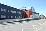
Ysgol Syr Hugh Owen

1894 establishments in WalesAll pages needing cleanupCaernarfonEducational institutions established in 1894Secondary schools in Gwynedd

Ysgol Syr Hugh Owen is a bilingual comprehensive secondary school for pupils aged 11–18. The school is situated in Caernarfon, Gwynedd, Wales. The school was established in 1894, the first to be built under the Welsh Intermediate Education Act 1889, which was heavily influenced by the educator Sir Hugh Owen, after whom the school was named. As of 2022, there were 937 pupils enrolled at the school. Its current headteacher is Paul Mathews Jones. It serves the town of Caernarfon and the nearby villages, which include; Bontnewydd, Caeathro, Y Felinheli, Llandwrog, Rhosgadfan and Rhostryfan.Welsh is the school's main language of communication and administration. All subjects, except Welsh and English, are taught to all pupils using both languages. According to the latest Estyn report, 90% of pupils speak Welsh with their families and 92% are fluent in the language. The school claims that 98% of pupils were fluent in Welsh in 2016.There is also a sixth form, which enables students to stay at the school for a further two years instead of having to transfer to college.

Excerpt from the Wikipedia article Ysgol Syr Hugh Owen (License: CC BY-SA 3.0, Authors).

Geographical coordinates (GPS)

Latitude Longitude
N 53.1462 ° E -4.2633 °
placeShow on map

Address

Ysgol Syr Hugh Owen

Llwyn Ceirios
LL55 1HW , Caernarfon
Wales, United Kingdom
mapOpen on Google Maps

Phone number

call+441286673076

linkWikiData (Q8059757)
linkOpenStreetMap (296091114)

Share experience

Nearby Places

Lôn Eifion

Lôn Eifion is part of Lôn Las Cymru, the Welsh National Cycle Route, which is about 400 km (250 mi) long. Lôn Eifion is the section which runs for 20 km (12 mi) from Caernarfon to Bryncir along most of the former Caernarfon to Afon Wen line. This line was that of the Carnarvonshire Railway (later LNWR and London, Midland and Scottish Railway), and joined with the Cambrian Coast Line at Afon Wen. Running alongside for part of the way is the trackbed of the old Nantlle Tramway, along which horse-drawn trams carried slates from the quarries in the Nantlle Valley to the port at Caernarfon from where they were exported. From Caernarfon to Llanwnda Station the Lôn Eifion runs alongside that of the Welsh Highland Railway. At the Llanwnda station the Lon Eifion continues south over Glanrhyd to the A487/A499 Pwheli/Porthmadog roundabout, which prior to the Penygroes bypass, was the site of the old Llanwnda Rail Station on the Carnarvonshire Railway. Crossing the roundabout you join the Llanwnda - Groeslon section of the route Lon Eifion, passing on your right the railway cottages built to serve the railway station. The route continues alongside the A487 before passing underneath the road bridge at Afon Llifon before continuing to the village of Groeslon. Crossing the road at the Tafarn Pennionyn the Lon Eifion continues on the East side of the A487 until crossing over again via a foot bridge. Once over the foot bridge the Lon Eifon cuts through woodland heading due South, passing the rear of Inigo Jones Slate Works and further on to open field land with views to the West of Pontllyfni and Aberdasach and The Rivals until reaching another footbridge at the end of Clynogg Road and continuing down to the roundabout of A487/B4418. Continuing south the Lon Eifion continues to closely follow the A487 until vearing away and more South Westerly at Nebo. It continues on a much quieter and greener route along the old railway line through trees and farm land down to Bryncir.At Bryncir the cycle route deviates from the old railway line and heads westerly and steeply upward through a farm and on to single track road before heading south again into Cricceith.

Caernarfon
Caernarfon

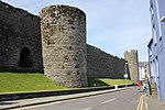
Caernarfon (; Welsh: [kaɨrˈnarvɔn] (listen)) is a royal town, community and port in Gwynedd, Wales, with a population of 9,852 (with Caeathro). It lies along the A487 road, on the eastern shore of the Menai Strait, opposite the Isle of Anglesey. The city of Bangor is 8.6 miles (13.8 km) to the north-east, while Snowdonia fringes Caernarfon to the east and south-east. Carnarvon and Caernarvon are Anglicised spellings that were superseded in 1926 and 1974 respectively. Abundant natural resources in and around the Menai Strait enabled human habitation in prehistoric Britain. The Ordovices, a Celtic tribe, lived in the region during the period known as Roman Britain. The Roman fort Segontium was established around AD 80 to subjugate the Ordovices during the Roman conquest of Britain. The Romans occupied the region until the end of Roman rule in Britain in 382, after which Caernarfon became part of the Kingdom of Gwynedd. In the late 11th century, William the Conqueror ordered the construction of a motte-and-bailey castle at Caernarfon as part of the Norman invasion of Wales. He was unsuccessful, and Wales remained independent until around 1283. In the 13th century, Llywelyn ap Gruffudd, ruler of Gwynedd, refused to pay homage to Edward I of England, prompting the English conquest of Gwynedd. This was followed by the construction of Caernarfon Castle, one of the largest and most imposing fortifications built by the English in Wales. In 1284, the English-style county of Caernarfonshire was established by the Statute of Rhuddlan; the same year, Caernarfon was made a borough, a county and market town, and the seat of English government in north Wales.The ascent of the House of Tudor to the throne of England eased hostilities with the English and resulted in Caernarfon Castle falling into a state of disrepair. The town has flourished, leading to its status as a major tourist centre and seat of Gwynedd Council, with a thriving harbour and marina. Caernarfon has expanded beyond its medieval walls and experienced heavy suburbanisation. The community of Caernarfon's population includes the highest percentage of Welsh-speaking citizens anywhere in Wales. The status of Royal Borough was granted by Queen Elizabeth II in 1963 and amended to Royal Town in 1974. The castle and town walls are part of a World Heritage Site described as the Castles and Town Walls of King Edward in Gwynedd.