place

Belmont, Western Australia

Belmont, Western AustraliaPerth, Western Australia geography stubsSuburbs in the City of BelmontSuburbs of Perth, Western AustraliaUse Australian English from February 2014
Belmont WA
Belmont WA

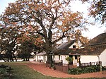
Belmont is a suburb of Perth, the capital city of Western Australia, and is located 7 kilometres (4 mi) east of Perth's central business district (CBD) on the southern bank of the Swan River. Its local government area is the City of Belmont. The suburb, part of a land grant assigned to Captain Francis Henry Byrne in 1831, was believed to have been named Belmont after Byrne's estate in England. The land was purchased by Shepherd Smith of Sydney in 1882, who subdivided it in 1897–1898.The local government body based in Belmont was originally known as the Belmont Park Road Board.The suburb was known as "Belmont Park" until being renamed in 1968.Today, the suburb is mixed-use in character. The western part of the suburb is primarily industrial and commercial, while the east and north are more residential, with various motels and other accommodation along Great Eastern Highway, which forms the suburb's north-western boundary. It contains two public schools—Belmont Primary School, and Belmont City College (formerly Belmont Senior High School)—as well as Centenary Park, Signal Hill Bushland, the Belgravia Residential Estate and a 500-metre (1,600 ft) section on the south bank of the Swan River. Belmont possesses a sister city partnership with Adachi, Tokyo in Japan, which has been in place since October 1984.

Excerpt from the Wikipedia article Belmont, Western Australia (License: CC BY-SA 3.0, Authors, Images).

Belmont, Western Australia
Vaucluse Circuit,

Geographical coordinates (GPS) Address Nearby Places
placeShow on map

Wikipedia: Belmont, Western AustraliaContinue reading on Wikipedia

Geographical coordinates (GPS)

Latitude Longitude
N -31.945 ° E 115.927 °
placeShow on map

Address

Vaucluse Circuit

Vaucluse Circuit
6103 , Belmont
Western Australia, Australia
mapOpen on Google Maps

Belmont WA
Belmont WA
Share experience

Nearby Places

Garratt Road Bridge
Garratt Road Bridge

Garratt Road Bridge consists of two adjacent bridges over the Swan River, linking the suburbs of Bayswater and Ascot in Perth, Western Australia. The upstream bridge was built in 1935, while the matching downstream bridge was built in 1972. The site was significant prior to the construction of Garratt Road Bridge – it featured in Aboriginal mythology, and was in the near vicinity of 1880s bridges for pedestrians and trains. From that time there were various proposal to provide a vehicular crossing between Bayswater and Bassendean. Interest peaked in 1928, but plans were delayed due to the Great Depression. The first bridge, designed by Main Roads Chief Engineer Ernest Godfrey, was constructed in 1934–35. It allowed two lanes of traffic to cross the Swan River, alongside pedestrians on an adjacent footbridge. Increasing traffic volume led to the bridge being widened by one and a half metres (5 ft) in 1962. By the end of that decade, a second bridge was being planned to cope with rising levels of congestion. It was constructed during 1971–72, but with only a 40-year design life as it was expected to be redundant once the planned Beechboro–Gosnells Highway (modern-day Tonkin Highway) opened. From the 1970s, Main Roads has maintained the bridges with procedures that vastly extended the bridges' lifespans, including concrete overlays on the decks, and retrofitting of steel girders. The heritage value of the structure was recognised in 1998, and Garratt Road Bridge was included in the City of Bayswater's Municipal Heritage Inventory. Eleven years later, in 2009, it was added to the state heritage list, and a permanent entry was given on 23 March 2010.