The Mixon

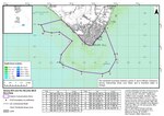
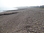
The Mixon (reef, rocks or shoal) are a limestone outcrop in the English Channel about 1 mile (1,600 m) off Selsey Bill, West Sussex. It was formed during the Eocene period. At the east end of the reef is a gully with a depth of 30 meters (98 ft). Known as the "Mixon Hole", this feature makes up the north side of a drowned river gorge. The Mixon is part of a Marine Conservation Zone and supports diverse wildlife including short-snouted seahorses, squat lobsters and crabs along with red algae and kelp in shallower waters. The Mixon Hole is a popular destination for scuba divers. Rock from the Mixon has been quarried at least from Roman times till the 19th century and used in the local building industry. The reef has been a major hazard to shipping over the centuries, with stories of wrecks dating from medieval times.
Excerpt from the Wikipedia article The Mixon (License: CC BY-SA 3.0, Authors, Images).The Mixon
Geographical coordinates (GPS) Address Nearby Places Show on map
Geographical coordinates (GPS)
| Latitude | Longitude |
|---|---|
| N 50.70666667 ° | E -0.77444444 ° |
Address
The Looe
PO20 0JN
England, United Kingdom
Open on Google Maps


