Selsey

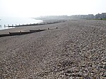
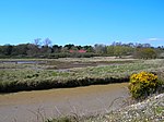
Selsey () is a seaside town and civil parish, about eight miles (12 km) south of Chichester in West Sussex, England. Selsey lies at the southernmost point of the Manhood Peninsula, almost cut off from mainland Sussex by the sea. It is bounded to the west by Bracklesham Bay, to the north by Broad Rife (rife being the local word for stream or creek), to the east by Pagham Harbour and terminates in the south at Selsey Bill. There are significant rock formations beneath the sea off both of its coasts, named the Owers rocks and Mixon rocks. Coastal erosion has been an ever-present problem for Selsey.The B2145 is the only road in and out of the town crossing a bridge over the water inlet at Pagham Harbour at a point known as "the ferry". At one time Selsey was inaccessible at flood tide, and a boat was stationed at the ferry to take horses and passengers to and from Sidlesham.
Excerpt from the Wikipedia article Selsey (License: CC BY-SA 3.0, Authors, Images).Selsey
High Street, Chichester
Geographical coordinates (GPS) Address Nearby Places Show on map
Geographical coordinates (GPS)
| Latitude | Longitude |
|---|---|
| N 50.73502 ° | E -0.78977 ° |
Address
Selsey Town Hall
High Street 55
PO20 0RB Chichester
England, United Kingdom
Open on Google Maps


