St Pancras Way
London geography stubsStreets in the London Borough of Camden

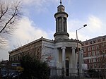
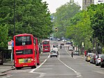
St Pancras Way is a road in Camden Town, London. It was formerly a toll road named Kings Road, and was the location of the St Pancras Workhouse, which is now the site of St Pancras Hospital. It was renamed to St Pancras Way in 1937.At one point, part of the River Fleet followed the route of St Pancras Way.The Constitution pub is situated at the crossing point of St Pancras Way with Regent's Canal.
Excerpt from the Wikipedia article St Pancras Way (License: CC BY-SA 3.0, Authors, Images).St Pancras Way
St Pancras Way, London Kentish Town (London Borough of Camden)
Geographical coordinates (GPS) Address Nearby Places Show on map
Geographical coordinates (GPS)
| Latitude | Longitude |
|---|---|
| N 51.54004 ° | E -0.13564 ° |
Address
St Pancras Way
St Pancras Way
NW1 0PU London, Kentish Town (London Borough of Camden)
England, United Kingdom
Open on Google Maps


