place

Bourne Grammar School

1921 establishments in EnglandAcademies in LincolnshireAll pages needing cleanupBourne, LincolnshireEducational institutions established in 1921
Grammar schools in LincolnshirePeople educated at Bourne Grammar SchoolUse British English from February 2023

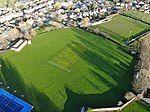
Bourne Grammar School (BGS) is a co-educational grammar school with academy status on South Road (A15), in Bourne, Lincolnshire, England. The school was founded in 1330. It previously held Arts College Status, and was awarded Academy status in January 2012, although it retains its former name.

Excerpt from the Wikipedia article Bourne Grammar School (License: CC BY-SA 3.0, Authors).

Bourne Grammar School
South Road, South Kesteven Bourne

Geographical coordinates (GPS) Address Phone number Website External links Nearby Places
placeShow on map

Wikipedia: Bourne Grammar SchoolContinue reading on Wikipedia

Geographical coordinates (GPS)

Latitude Longitude
N 52.76246 ° E -0.37334 °
placeShow on map

Address

Bourne Grammar School

South Road
PE10 9JE South Kesteven, Bourne
England, United Kingdom
mapOpen on Google Maps

Phone number

call+441778422288

Website
bourne-grammar.lincs.sch.uk

linkVisit website

linkWikiData (Q4950240)
linkOpenStreetMap (240912544)

Share experience

Nearby Places

Bourne Eau
Bourne Eau

Bourne Eau is a short river which rises from an artesian spring in the town of Bourne in Lincolnshire, England, and flows in an easterly direction to join the River Glen at Tongue End. Within the town, it once powered three water mills, one of which is now a heritage centre. At Eastgate, it becomes much wider as it was navigable in the 18th and 19th centuries, and this was the location of the terminal basin. Below the town it is an embanked river, as its normal level is higher than that of the surrounding Fens. Navigation ceased in the 1860s and the river now forms an important part of the drainage system that enables the surrounding fen land to be used for agriculture. The artesian spring is fed by a limestone aquifer, which has been extensively used to supply drinking water to the locality and to Spalding. After a period of low rainfall in the late 1980s, the spring and hence the upper river dried up completely. A remediation project was implemented in 1992/93 to repair wild boreholes, where artesian water was uncontrollably running to waste. 30 boreholes were plugged or repaired, and water returned to the spring and river. The river divides North Fen from South Fen. Both were enclosed in the 1770s, and surplus water from the North Fen was fed to the South Forty-Foot Drain. Steam pumping was introduced in 1845, and the drainage is the responsibility of the Black Sluice Internal Drainage Board (IDB). To drain the South Fen Gilbert Heathcote's tunnel was constructed to take water under the River Glen to the Counter Drain. Various engines were used to pump water through the tunnel, but after the failure of a gas engine in 1942, a new pumping station was built, to pump water into the River Glen. Drainage in the South Fen is now the responsibility of the Welland and Deepings IDB.