place

Broad Sound North Entrance Channel

Boston geography stubsChannels of the United States

The Broad Sound North Entrance Channel or Boston North Channel is the deepest of three shipping channels connecting Boston Harbor to Massachusetts Bay near Boston, Massachusetts. For this reason, almost all deep-draft ships use this channel.The 1,500' wide channel starts south of the Deer Island Light at the eastern end of the President’s Roads anchorage and proceeds northeastward to Broad Sound, passing eastward of Finn's Ledge. The channel's depth was recently increased to 51 feet in order to attract the larger New Panamax ships in use since the Panama Canal expansion project's 2016 completion.

Excerpt from the Wikipedia article Broad Sound North Entrance Channel (License: CC BY-SA 3.0, Authors).

Broad Sound North Entrance Channel
Boston

Geographical coordinates (GPS) Address Nearby Places
placeShow on map

Wikipedia: Broad Sound North Entrance ChannelContinue reading on Wikipedia

Geographical coordinates (GPS)

Latitude Longitude
N 42.354722222222 ° E -70.931944444444 °
placeShow on map

Address

Boston


Boston
Massachusetts, United States
mapOpen on Google Maps

Share experience

Nearby Places

Lovells Island
Lovells Island

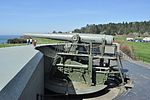
Lovells Island, or Lovell's Island, is a 62-acre (250,000 m2) island in the Boston Harbor Islands National Recreation Area, in Massachusetts. The island is across The Narrows from Georges Island and some 7 miles (11 km) offshore of downtown Boston. It is named after Captain William Lovell, who was an early settler of nearby Dorchester. The island is known as the site of several shipwrecks, including the 74-gun French warship Magnifique in 1782.In December 1786, a passenger boat carrying 13 people crashed off the shore of Lovells Island. Coming from Damariscotta, Maine, and destined for the Boston Harbor, the boat sank within swimming distance to the Harbor, and all aboard made it to shore. Without shelter or warmth and in the midst of a blizzard, 11 of the victims froze to death. One man, Theodore Kingsbury, made it through the night and was taken to the hospital in the morning where he was pronounced dead. Two of the victims aboard the ship, a Miss Sylvia Knapp and her fiancé (name unknown), were said to be found holding on to each other for warmth on top of a boulder, now dubbed "Lovers Rock". The Humane Society of the Commonwealth of Massachusetts constructed lifesaving huts in November 1787 around the harbor and the coast of Massachusetts, one on Lovells Island.Lovells Island has had a succession of owners. In 1767, the town of Charlestown deeded the island to Elisha Leavitt Jr. of Hingham, Massachusetts, an infamous Tory who also owned Grape Island, where Leavitt later invited British forces to help themselves to his hay until they were chased off by patriots. Leavitt's payment for Lovells Island was set aside to pay for the town's school.Lovells Island was used by Native Americans for fishing, gardening and trading. Later uses included harvesting the island's timber, as a fishing station, as a residence for the keepers of Boston Light, and as a rabbit run. Once the home of the Lovells Island Range Lights, the island was a buoy tending station in the early 20th century and was fortified before and during World War I, with remains of Fort Standish, active 1902-1946, still visible.Much of the vegetation on the islands results from an attempt in the 1930s by the Civilian Conservation Corps to reestablish a natural forest on the island, although this was largely cleared when the fort was reactivated during World War II. Left to recover after the war, the island's plant life now includes remnant patches of stands of poplar, pine and spruce, together with successional species such as staghorn sumac, black cherry, chokecherry, apple, and gray birch. Common shrubs include bayberry, beach plum, raspberry, Virginia rose and saltspray rose.Today, Lovells Island is a popular camping island, with picnic areas and walking trails through its dunes and woods, together with a non-supervised swimming beach. On weekends and summer weekdays, it is served by a shuttle boat to and from Georges Island, connecting there with ferries to Boston and Quincy.

Deer Island Light
Deer Island Light

Deer Island Light is a lighthouse in Boston Harbor, Boston, Massachusetts. The actual light is 53 feet (16 m) above Mean High Water. Its alternating white and red light is visible for 9 nautical miles (17 km; 10 mi). The light is at the end of a reef that extends about 1,500 feet (460 m) south from Deer Island. The location first had a stone beacon in 1832. The first light, a sparkplug type light, was lit in 1890. It cost about $50,000. It included a three-story dwelling, a veranda with boat davits, and a circular parapet. The water supply was a cistern in the base of the structure. A spiral staircase ran from the cellar to the top floor. It had a fixed white light, which was changed to flashing red every thirty seconds and then to the present alternating red and white flashes. The old light gradually deteriorated and was replaced in 1982 by a white fiberglass tower. The white tower raised complaints because it blended in with the background and was hard to see, so the Coast Guard moved it to Great Point Light, Nantucket, as a temporary replacement when that tower was destroyed by a storm in March 1984. A brown fiberglass tower was installed immediately thereafter. While the Spark plug light was interesting, it was much more expensive to maintain than the fiberglass structure. Imported from England, the pole light was the first of its kind in the United States.Between October 2015 and May 2016, the brown tower was dismantled and the light was moved about 100 feet (30 m) south of its previous foundation structure. The new light uses LED technology and sits on a steel skeletal tower, atop four piles. Like other lights in Boston Harbor, the automatic fog signal has been replaced by a Mariner Radio Activated Sound Signal (MRASS) which can be activated by nearby mariners by tuning their marine VHF radio to channel 83A (157.17 5Mhz) and keying the transmitter five times consecutively.

Gallops Island
Gallops Island

Gallops Island, also known as Gallups Island, is an island in the Boston Harbor Islands National Recreation Area. It is situated between Georges Island and Long Island, and is just over 6 miles (9.7 km) from downtown Boston. The island has a permanent size of 23 acres (93,000 m2), plus an intertidal zone of a further 28 acres (110,000 m2), and is composed of one large drumlin, reaching an elevation of 79 feet (24 m) above sea level. The island has a rocky beach and offers long vistas from the top of its grassy bluffs. Gallops Island is closed until asbestos remediation is completed.The island is named after John Gallop, one of Boston Harbor's first pilots, who lived on the island. Since then the island has been occupied by a restaurant and inn and a quarantine station. During the Civil War the island was occupied by a military camp housing 3,000 Union soldiers, and during World War II it was occupied by a radio school and a school for bakers and cooks. During World War I, Gallops Island was used as an infirmary for thousands of American soldiers who contracted "Spanish influenza" and pneumonia. Many died every day, to be replaced by new arrivals. The island contains a collection of ornamental trees, shrubs and herbaceous plants that date back to its earlier uses, with additional trees being planted by the Civilian Conservation Corps in the 1930s. Photographs from the 1940s show that a tree lined street extended the length of the island. Although the buildings have been demolished, the pathways and foundations still exist and are lined with privet hedges and surrounded by fruit, shade and coniferous trees, including lilacs, mock-orange, snowberry, and forsythia. Also present are self-sown sumac, poplar, poison ivy, and bayberry. The vegetation has been badly damaged in recent years by the island's population of rabbits.Gallops Island was closed in 2000 due to the presence of asbestos-containing building debris from former military uses. The Massachusetts Department of Conservation and Recreation has determined that the island will be closed to the public until visitors can be welcomed back safely. As of August 2010, it was predicting a re-opening no earlier than 2015, presuming remediation funding could be obtained.