Deer Island (Massachusetts)

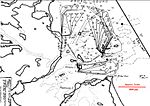
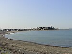
Deer Island is a peninsula in Boston, Massachusetts. Since 1996, it has been part of the Boston Harbor Islands National Recreation Area. Although still an island by name, Deer Island has been connected to the mainland since the former Shirley Gut channel, which once separated the island from the town of Winthrop, was filled in by the 1938 New England hurricane. Today, Deer Island is the location of the Deer Island Waste Water Treatment Plant, whose 150-foot-tall (46 m) egg-like sludge digesters are major harbor landmarks. The island's permanent size is 185 acres (0.75 km2), plus an intertidal zone of a further 80 acres (320,000 m2). Two-thirds of the island's area is taken up with the wastewater plant, which treats sewage from 43 nearby cities and towns, and is the second-largest such plant in the United States. The remainder of the island is park land surrounding the treatment plant, and offers walking, jogging, sightseeing, picnicking, and fishing.
Excerpt from the Wikipedia article Deer Island (Massachusetts) (License: CC BY-SA 3.0, Authors, Images).Deer Island (Massachusetts)
Deer Island Road, Boston
Geographical coordinates (GPS) Address Nearby Places Show on map
Geographical coordinates (GPS)
| Latitude | Longitude |
|---|---|
| N 42.351666666667 ° | E -70.958611111111 ° |
Address
Deer Island Road 1
02152 Boston
Massachusetts, United States
Open on Google Maps


