place

Fort Dawes

Demolished buildings and structures in MassachusettsEast BostonForts in Massachusetts
Boston Mines 1945
Boston Mines 1945

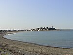
Fort Dawes was a World War II Coast Artillery fort located on Deer Island in Winthrop/Boston, Massachusetts. It was part of the Harbor Defenses of Boston.

Excerpt from the Wikipedia article Fort Dawes (License: CC BY-SA 3.0, Authors, Images).

Fort Dawes
Deer Island Road, Boston

Geographical coordinates (GPS) Address Nearby Places
placeShow on map

Wikipedia: Fort DawesContinue reading on Wikipedia

Geographical coordinates (GPS)

Latitude Longitude
N 42.348894444444 ° E -70.956488888889 °
placeShow on map

Address

Deer Island Road 1
02152 Boston
Massachusetts, United States
mapOpen on Google Maps

Boston Mines 1945
Boston Mines 1945
Share experience

Nearby Places

Deer Island Light
Deer Island Light

Deer Island Light is a lighthouse in Boston Harbor, Boston, Massachusetts. The actual light is 53 feet (16 m) above Mean High Water. Its alternating white and red light is visible for 9 nautical miles (17 km; 10 mi). The light is at the end of a reef that extends about 1,500 feet (460 m) south from Deer Island. The location first had a stone beacon in 1832. The first light, a sparkplug type light, was lit in 1890. It cost about $50,000. It included a three-story dwelling, a veranda with boat davits, and a circular parapet. The water supply was a cistern in the base of the structure. A spiral staircase ran from the cellar to the top floor. It had a fixed white light, which was changed to flashing red every thirty seconds and then to the present alternating red and white flashes. The old light gradually deteriorated and was replaced in 1982 by a white fiberglass tower. The white tower raised complaints because it blended in with the background and was hard to see, so the Coast Guard moved it to Great Point Light, Nantucket, as a temporary replacement when that tower was destroyed by a storm in March 1984. A brown fiberglass tower was installed immediately thereafter. While the Spark plug light was interesting, it was much more expensive to maintain than the fiberglass structure. Imported from England, the pole light was the first of its kind in the United States.Between October 2015 and May 2016, the brown tower was dismantled and the light was moved about 100 feet (30 m) south of its previous foundation structure. The new light uses LED technology and sits on a steel skeletal tower, atop four piles. Like other lights in Boston Harbor, the automatic fog signal has been replaced by a Mariner Radio Activated Sound Signal (MRASS) which can be activated by nearby mariners by tuning their marine VHF radio to channel 83A (157.17 5Mhz) and keying the transmitter five times consecutively.

Long Island Head Light

Long Island Head Light is an historic lighthouse on Long Island in Boston Harbor, Boston, Massachusetts. The current brick tower is the fourth lighthouse on the island. The light was first established in 1819, largely as a result of a study conducted by the Boston Marine Society, which had built the daybeacon on Nixes Mate 14 years earlier. It was a 20-foot (6.1 m) stone tower known as "Inner Harbor Light". It was the second of the four Boston lights—103 years after Boston Light, but ten years before the first daybeacon at the site of Deer Island Light, and before The Graves Light, built in 1905. In 1853, it was reported in the New England Farmer, that Captain Charles A. Beck, was keeper of the Light for twenty-eight years.The stone tower fell into disrepair and was replaced by one of the earliest cast iron lighthouse structures, thirty-four feet tall (pictured below). In 1857, a fourth order Fresnel lens replaced the lamps and reflectors which had been in place. During the next twenty years it sustained damage in a number of storms. In 1881, it was replaced again, by a conical cast iron structure and a new wood keeper's house. Fort Strong was significantly enlarged around the start of the 20th century and it was necessary to move the lighthouse to a location out of the way of the concussion from the guns, so the current brick tower was constructed in 1900-01. Remnants of the fort can be seen to the southeast of the light in the satellite views available by clicking on the coordinates.The Coast Guard discontinued the light in 1982, but reconsidered the decision in 1985, and installed a modern, solar powered system. It received a major refurbishing in the summer of 1998.Long Island Head Light was added to the National Register of Historic Places as Long Island Head Light on June 15, 1987.

Snake Island (Massachusetts)

Snake Island, also known as Bare Island, is an island in Boston Harbor. The island is part of the Boston Harbor Islands National Recreation Area and is situated in the inner harbor between the town of Winthrop and the reclaimed land that forms Logan International Airport. It is part of the Town of Winthrop. It is named for its serpentine shape, and has a permanent size of 3 acres (12,000 m2), and rises to a height of 10 feet (3.0 m) above sea level.Since the 18th century the island has been owned by variety of owners, and has been used for livestock grazing, and as a squatter camp occupied by lobstermen and clammers. In the 1900s a grounded steamer served as residence for lobstermen from Winthrop. Today the island is uninhabited and classified as "conservation land". Access is by private boat only.The island is less than 1/4 mile from two shores of the Town of Winthrop. Unique among the Boston Harbor Islands, it has an interior lagoon which fills and partly drains, with the tide. The water entrance to the lagoon is winding and only six feet wide, not navigable for even a canoe or kayak, except at an unusually high tide. The lagoon and lack of predators makes the island attractive to birds, including migratory species. It is posted off-limits in the spring, when many bird species nest there. In recent years the island has increased in area, due to shoaling of the surrounding water, especially to the west; its long "tail" is now fully exposed at low tide. Access is only possible by beachable small craft, due to very shallow water and mud flats around the island.