Tilmanstone
Civil parishes in KentDover DistrictMining communities in EnglandVillages in Kent

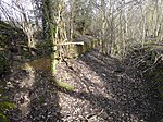
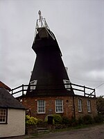
Tilmanstone is a small village and civil parish in Kent, in the South East of England, near Eastry, a much bigger and more developed area. Tilmanstone no longer has a village school; however, the independent Northbourne Park School is close to the parish boundary. The name of Tilmanstone has historically been famous for its colliery, although it is located in the village of Eythorne, operated from 1906 to 1986 as one of the four main pits of the Kent coalfield. The population taken at the 2011 Census also included that of the nearby hamlet of Ashley.
Excerpt from the Wikipedia article Tilmanstone (License: CC BY-SA 3.0, Authors, Images).Tilmanstone
St. Andrews Way,
Geographical coordinates (GPS) Address Nearby Places Show on map
Geographical coordinates (GPS)
| Latitude | Longitude |
|---|---|
| N 51.215 ° | E 1.295 ° |
Address
St. Andrews Way
St. Andrews Way
CT14 0JH
England, United Kingdom
Open on Google Maps


