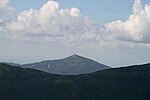
South Branch Gale River
New Hampshire river stubsRivers of Grafton County, New HampshireRivers of New HampshireTributaries of the Connecticut River

The South Branch of the Gale River is a 5.1-mile-long (8.2 km) river in the White Mountains of New Hampshire in the United States. Via the Gale River, it is a tributary of the Ammonoosuc River and part of the Connecticut River watershed. The South Branch rises on the north slope of Mount Lafayette in the town of Franconia, New Hampshire, west of Garfield Ridge. It drops rapidly to the north and joins the North Branch to form the Gale River at the crossing of U.S. Route 3. The South Branch provides drinking water for the town of Bethlehem, New Hampshire.
Excerpt from the Wikipedia article South Branch Gale River (License: CC BY-SA 3.0, Authors, Images).South Branch Gale River
Daniel Webster Highway,
Geographical coordinates (GPS) Address Nearby Places Show on map
Geographical coordinates (GPS)
| Latitude | Longitude |
|---|---|
| N 44.243611111111 ° | E -71.638055555556 ° |
Address
Daniel Webster Highway
Daniel Webster Highway
New Hampshire, United States
Open on Google Maps


