place

East Riding of Yorkshire

Administrative counties abolished in 1974Ceremonial counties of EnglandCounties of England established in 1996East Riding of YorkshireLocal government districts of Yorkshire and the Humber
Local government districts of the East Riding of YorkshireUnitary authority districts of EnglandUse British English from November 2013
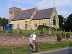
Flamborough Head geograph.org.uk 4010883 (cropped)

The East Riding of Yorkshire, often abbreviated to the East Riding or East Yorkshire, is a ceremonial county in the Yorkshire and the Humber region of England. It borders North Yorkshire to the north and west, South Yorkshire to the south-west, and Lincolnshire to the south across the Humber Estuary. The city of Kingston upon Hull is the largest settlement. The county has an area of 2,479 km2 (957 sq mi) and a population of 600,259. Kingston upon Hull is by far the largest settlement, with population of 267,014, and is a major port and the county's economic and transport centre. The rest of the county is largely rural, and the next largest towns are the seaside resort of Bridlington (35,369) and the historic town of Beverley (30,351). The county is governed by two unitary authorities, East Riding of Yorkshire Council and Hull City Council. It takes its name from the East Riding, a historic subdivision of Yorkshire. In the east of the county the low-lying plain of Holderness is enclosed by a crescent of low chalk hills, the Yorkshire Wolds. The Wolds meet the sea at Flamborough Head, a chalk headland, while the Holderness coast to the south is characterised by clay cliffs. The west of the county is part of the Vale of York, the wide plain of the River Ure/Ouse; the south-west is part of the Humberhead Levels.

Excerpt from the Wikipedia article East Riding of Yorkshire (License: CC BY-SA 3.0, Authors, Images).

East Riding of Yorkshire
Lund Road,

Geographical coordinates (GPS) Address Nearby Places
placeShow on map

Wikipedia: East Riding of YorkshireContinue reading on Wikipedia

Geographical coordinates (GPS)

Latitude Longitude
N 53.916666666667 ° E -0.5 °
placeShow on map

Address

Lund Road

Lund Road
YO25 9SJ , Lockington
England, United Kingdom
mapOpen on Google Maps

Flamborough Head geograph.org.uk 4010883 (cropped)
Share experience

Nearby Places

South Dalton
South Dalton

South Dalton is a village and former civil parish, now in the parish of Dalton Holme, in the East Riding of Yorkshire, England. It is situated 6 miles (10 km) north-east of Market Weighton and 5 miles (8 km) north-west of Beverley. Etton lies 2 miles (3.2 km) to the south-east. North Dalton is 5 miles (8 km) north-west, with the villages of Middleton on the Wolds and Lund between. In 1931 the parish had a population of 233. On 1 April 1935 the parish was abolished and merged with Holme on the Wolds to form "Dalton Holme".The village forms part the Dalton Estate, owned and managed by the Hotham family which has possessed land in the area for generations. The 18th-century hall is the home of Lord Hotham. The Dalton Estate office is within the village. The Estate houses are of rows of cottages and Tudor style houses, some with date plates dating as far back as 1706. According to A Dictionary of British Place Names the village name derives from the Old English for a "farmstead or village in a valley." South Dalton is listed in the Domesday Book as "Delton". At the time of the survey the settlement was in the Hundred of Sneculfcros in the East Riding of Yorkshire. It contained twelve households, twelve villagers, and six ploughlands. In 1066 Ealdred, the Archbishop of York, held the Lordship, this transferring by 1086 to the canons of Beverley, with Thomas of Bayeux, the later Archbishop of York, as Tenant-in-chief to King William I. By 1260 the settlement name was recorded as "Suthdalton".In 1823 South Dalton was a village and civil parish in the Wapentake of Harthill. Population at the time was 277. Occupations included twelve farmers, a shopkeeper, a boot & shoe maker, a carpenter & wheelwright, a blacksmith, and the landlord of The Board public house. A weaver was also the parish clerk. Three carriers operated between the village and Beverley once a week.

Etton, East Riding of Yorkshire

Etton is a village and civil parish in the East Riding of Yorkshire, England. It is situated approximately 4 miles (6 km) north-west of Beverley town centre and 2 miles (3.2 km) west of the village of Leconfield. 1 mile (1.6 km) to the south-east is Cherry Burton. To the west lie the hamlets of Kiplingcotes (3 miles (5 km) away due west) and Gardham (1.5 miles (2.4 km) to the south-west). South Dalton lies 1.5 miles to the north-west. The village itself lies to the west of the B1248 road in its own shallow dale. The village's buildings are almost entirely situated either side of Main Street. Along this street lie both the village pub and the parish church of St Mary, which is a Grade II* listed building.The civil parish is formed by the village of Etton and part of the hamlet of Kiplingcotes. According to the 2011 UK Census, Etton parish had a population of 277, a decrease on the 2001 UK Census figure of 285.Etton is significant as the 1584 birthplace of Rev John Lothropp, founder of Barnstable, Massachusetts. Several Lothropp family members have death or burial dates recorded as 6 January 1588, but as there is no record of a catastrophic event on that date, it is believed to be merely a recording date to catch up on vital statistics which had gone unreported for some length of time.Thomas Carling, who emigrated from Etton to Canada in 1818, used 'a recipe from his native Yorkshire' to found the Carling Brewery in 1840.Etton is also home to the Holderness Hunt, whose kennels are located on the south-east of the village. In 1823 Etton was in the Wapentake of Harthill. The village had a population of 380, with occupations including nine farmers, two shopkeepers, a carpenter & wheelwright, a boot & shoe maker, a tailor, a corn miller, and the landlord of the Light Dragoon public house. There were two gentlemen, one gentlewoman, a Lady, a vicar, and a schoolmaster who was also the parish clerk. Once a week two carriers operated between the village and Beverley. The patron of the village Church of St Mary was the Archbishop of York.Etton has been known to suffer quite badly during floods, due to its position in a small valley, with the most recent flood on 25 June 2007.