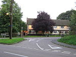
Slip End

Slip End is a village and civil parish in Central Bedfordshire, England. The village is located very near to Luton. As well as the village of Slip End, the parish contains the hamlets of Lower Woodside, Woodside and Pepperstock. In 2021 it had a population of 1,842.The name of Slip End possibly has a connection with brickworks. Slip is an old English word for clay and End is a common part of place names in Bedfordshire and not unknown in other counties. End refers to small settlements outside larger villages. It is, therefore, possible that Slip End was named in the early 19th century because of the small number of houses built near the new brickworks in an area not previously developed with the older settlements of Woodside and Pepperstock to either side. Nearby Markyate has a Slype Lane which may or not be connected. Another plausible explanation is that 'the slip' in fact is a very deep deposit of clay, situated between the stratas of chalk which form the bedrock of Central Bedfordshire. The southerly extremity of the slip terminates at the appropriately named Slip End.
Excerpt from the Wikipedia article Slip End (License: CC BY-SA 3.0, Authors, Images).Slip End
Grove Road,
Geographical coordinates (GPS) Address Nearby Places Show on map
Geographical coordinates (GPS)
| Latitude | Longitude |
|---|---|
| N 51.855 ° | E -0.434 ° |
Address
Grove Road
Grove Road
LU1 4BU
England, United Kingdom
Open on Google Maps


