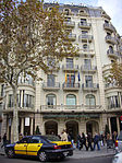
Casa Batlló (Catalan pronunciation: [ˈkazə βəˈʎːo]) is a building in the center of Barcelona. It was designed by Antoni Gaudí, and is considered one of his masterpieces. A remodel of a previously built house, it was redesigned in 1904 by Gaudí and has been refurbished several times after that. Gaudí's assistants Domènec Sugrañes i Gras, Josep Canaleta and Joan Rubió also contributed to the renovation project.
The local name for the building is Casa dels ossos (House of Bones), as it has a visceral, skeletal organic quality. It is located on the Passeig de Gràcia in the Eixample district, and forms part of a row of houses known as the Illa de la Discòrdia (or Mansana de la Discòrdia, the "Block of Discord"), which consists of four buildings by noted Modernista architects of Barcelona.Like everything Gaudí designed, Casa Batlló is only identifiable as Modernisme or Art Nouveau in the broadest sense. The ground floor, in particular, has unusual tracery, irregular oval windows and flowing sculpted stone work. There are few straight lines, and much of the façade is decorated with a colorful mosaic made of broken ceramic tiles (trencadís). The roof is arched and was likened to the back of a dragon or dinosaur. A common theory about the building is that the rounded feature to the left of centre, terminating at the top in a turret and cross, represents the lance of Saint George (patron saint of Catalonia, Gaudí's home), which has been plunged into the back of the dragon.
In 2005, Casa Batlló became an UNESCO World Heritage Site among the other Works of Antoni Gaudí, and is visited by people from around the world.
