place

2023 Monterey Park shooting

2023 crimes in California2023 in Los Angeles County, California2023 mass shootings in the United States2023 murders in the United States21st-century mass murder in the United States
Attacks in the United States in 2023Attacks on buildings and structures in CaliforniaChinese New YearDeaths by firearm in CaliforniaJanuary 2023 crimes in the United StatesMass murder in CaliforniaMass shootings in CaliforniaMass shootings in the United StatesMassacres in 2023Massacres in the United StatesMonterey Park, CaliforniaMurder in Los Angeles County, CaliforniaMurder–suicides in CaliforniaTaiwanese people murdered abroadUse mdy dates from March 2023

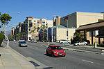
On January 21, 2023, a mass shooting occurred in Monterey Park, California, United States. The gunman killed eleven people and injured nine others. The shooting happened at about 10:22 p.m. PST (UTC-8) at Star Ballroom Dance Studio, after an all-day Lunar New Year Festival was held on a nearby street. Shortly afterwards, the gunman drove north to Lai Lai Ballroom in nearby Alhambra to continue his shooting spree but was confronted by staff and disarmed before fleeing by car. The perpetrator was identified as 72-year-old Huu Can Tran. He died from a self-inflicted gunshot wound during a standoff with police in Torrance the next day. It is the deadliest mass shooting in the history of Los Angeles County.

Excerpt from the Wikipedia article 2023 Monterey Park shooting (License: CC BY-SA 3.0, Authors).

2023 Monterey Park shooting
Garvey Avenue,

Geographical coordinates (GPS) Address Nearby Places
placeShow on map

Wikipedia: 2023 Monterey Park shootingContinue reading on Wikipedia

Geographical coordinates (GPS)

Latitude Longitude
N 34.061944444444 ° E -118.12361111111 °
placeShow on map

Address

T.S. Emporium

Garvey Avenue
91755
California, United States
mapOpen on Google Maps

Share experience

Nearby Places

Wilmar, California

Wilmar was the former name of a then-unincorporated district of San Gabriel Township in the San Gabriel Valley, about eight miles east of the center of Los Angeles. In the 1940 census, Wilmar had a population of 11,590. Wilmar was combined with the unincorporated communities of Garvey (to the east of Wilmar) and Potrero Heights (to the south of Wilmar) to become the unincorporated community of South San Gabriel in the early 1950s. It was named for the city of Wilmar, Arkansas by "Arkies" who migrated to the area as a rural counterpart to their roots in Arkansas. Most of South San Gabriel was later annexed by the city of Rosemead (mostly during the mid-1960s), though parts of it were annexed by other adjacent cities and part of it remains unincorporated today. Most of the area of South San Gabriel which had been called Wilmar was annexed by Rosemead, but one section of it lying north of the San Bernardino Freeway between New Avenue and San Gabriel Boulevard was annexed by the city of San Gabriel. The main streets of Wilmar were Del Mar Avenue, Graves Avenue, Hellman Avenue, Ramona Boulevard, and Garvey Avenue. It was the site of a Los Angeles County branch library, and of three schools of the Garvey School District. The area of Wilmar known as Potrero Heights, south of the intersection of Del Mar and Graves Avenues, came to be known in the 1950s as Garvey Hills. This area was first home of the Wilmar gang, members were identified by their tattoo of the name Wilmar and a picture of a donkey. Later as the ethnicity of the area changed, it became home to the infamous Lomas gang, one of Los Angeles' earliest Hispanic gangs.

Alhambra Airport
Alhambra Airport

Alhambra Airport also called the Western Air College Airport was an airport in Alhambra, California from 1928 to 1946. The Airport was founded by the Western Air Express on 157-acre of land. The airport had a single 2,830-foot asphalt northeast–southwest runway. The Western Air Express built a unique hangar, that was a 44-foot hexagonal shape able to work on 6 aircraft at once. Western Air Express also build an air terminal building and a conventional hangar. Western Air Express at the opening operated Fokker F-32 from the airport. Western Air Express held a large dedication ceremony on April 17, 1930 for the new air terminal. The US Forest Service operated a patrol aircraft out of the airport to keep an eye out on the nearby San Gabriel Mountains. Just one year after the dedication ceremony, both Western Air Express and Transcontinental, which also had flights out of the airport, moved to the Burbank Airport and Glendale Grand Central Airport. With no scheduled flights, the Alhambra Airport became a private airport. A Western Air College flight school opened at the airport and some other small commercial operations. With Hollywood only 15 miles away the Alhambra Airport became a popular spot to shoot movies. The 1936 movie 13 Hours by Air directed by Mitchell Leisen and starring Fred MacMurray and Joan Bennett was shot at the airport. In 1939 the film Danger Flight was shot at the airport, directed by Howard Bretherton, starring John Trent as Tailspin Tommy Tompkins, Marjorie Reynolds, Milburn Stone and Jason Robards Sr. The film featured young aviation enthusiasts in a model club. The four-seat cabin monoplane, Harlow PJC-2 designed by Max B. Harlow was built at the Alhambra Airport in 1937. To support the build-up of the World War 2 effort, the Alhambra Airport was used as a depot for Lockheed Corporation military airplanes, many P-38 Lightning fighters aircraft came, were packed and departed the depot on the Lend Lease Program. In 1941 the Flying Wild and They Met in Bombay were shot at the airport. In 1942 the movie Flight Lieutenant was shot at the airport. In 1943 the airport was sold to the city. Harlow Aircraft Company purchased the airport in 1945. Harlow Aircraft Company had been building small aircraft at the airport since 1936 in small qualities. In 1946 Harlow Aircraft Company sold the airport to real estate developers, the north part of the site is now commercial property and the remaining is houses. The Airport was located at what is now Valley Boulevard to the north, New Ave to the east, Almansor Street to the west and the Interstate 10 to the south. Western Air Express later became part of Western Airlines. Western Air College Airport also operated out of the Rosemead Airport for some years. Western Air Express operated out of the Vail Airport in Montebello before moving its operation to the Alhambra Airport.