place

Alhambra High School (Alhambra, California)

1898 establishments in CaliforniaAlhambra, CaliforniaEducational institutions established in 1898Public high schools in Los Angeles County, California

Alhambra High School (AHS) is a public high school in Alhambra, California established in 1898. It is a part of the Alhambra Unified School District. The school is located on Second Street, across the street from City Hall and the Police Department, bounded by Second Street, Commonwealth Avenue, Fifth Street, and Main Street. The campus is divided into three parts, by Third and Fourth Streets.

Excerpt from the Wikipedia article Alhambra High School (Alhambra, California) (License: CC BY-SA 3.0, Authors).

Alhambra High School (Alhambra, California)
2nd Street,

Geographical coordinates (GPS) Address Website External links Nearby Places
placeShow on map

Wikipedia: Alhambra High School (Alhambra, California)Continue reading on Wikipedia

Geographical coordinates (GPS)

Latitude Longitude
N 34.092837 ° E -118.128412 °
placeShow on map

Address

Alhambra High School

2nd Street 101
91801
California, United States
mapOpen on Google Maps

Website
ahsmoors.org

linkVisit website

linkWikiData (Q19871954)
linkOpenStreetMap (14697289)

Share experience

Nearby Places

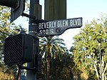
Beverly Glen Boulevard

Beverly Glen Boulevard is one of six major routes that connect the Westside of Los Angeles to the San Fernando Valley (the other five are the San Diego (405) Freeway, Sepulveda Boulevard, Topanga Canyon Boulevard, Laurel Canyon Boulevard, and Coldwater Canyon Avenue. It starts at Rancho Park Golf Course on Pico Boulevard in West Los Angeles. It proceeds to intersect with Santa Monica and Wilshire boulevards, passing near Century City, Sinai Temple and Los Angeles Country Club. The road marks the eastern border of the Westwood Prosperity Unit development built by Janss Investment Company as the foundation of the Westwood neighborhood of Los Angeles. As the road travels further north, it intersects with Sunset Boulevard near UCLA and passes the gated communities of Bel Air and the middle school campus of the Harvard-Westlake School. The hills through which the boulevard passes north of Sunset and south of Mulholland Drive is known as Beverly Glen. Beverly Glen runs parallel to the wealthy section of Bel-Air and its gated communities. The housing development at Beverly Glen and Mulholland was laid out in the 1950s and was originally known as Glen-Aire. After passing Mulholland, Beverly Glen Boulevard swerves west and passes through the exclusive hillside homes in Sherman Oaks. "Stilt Street" is a row of twenty stilt houses designed by architect Richard Neutra that perch on the steep hillside above the boulevard. The road ends at Ventura Boulevard in the south end of the Valley. Commuters seeking to go further north into the Valley go one block west to Van Nuys Boulevard which spans most of the Valley's length. Beverly Glen Boulevard is east of Sepulveda Boulevard and the San Diego Freeway (I-405). When traffic on I-405 becomes unbearable, many commuters take Beverly Glen or Sepulveda instead, causing considerable congestion on both streets.

Alhambra Airport
Alhambra Airport

Alhambra Airport also called the Western Air College Airport was an airport in Alhambra, California from 1928 to 1946. The Airport was founded by the Western Air Express on 157-acre of land. The airport had a single 2,830-foot asphalt northeast–southwest runway. The Western Air Express built a unique hangar, that was a 44-foot hexagonal shape able to work on 6 aircraft at once. Western Air Express also build an air terminal building and a conventional hangar. Western Air Express at the opening operated Fokker F-32 from the airport. Western Air Express held a large dedication ceremony on April 17, 1930 for the new air terminal. The US Forest Service operated a patrol aircraft out of the airport to keep an eye out on the nearby San Gabriel Mountains. Just one year after the dedication ceremony, both Western Air Express and Transcontinental, which also had flights out of the airport, moved to the Burbank Airport and Glendale Grand Central Airport. With no scheduled flights, the Alhambra Airport became a private airport. A Western Air College flight school opened at the airport and some other small commercial operations. With Hollywood only 15 miles away the Alhambra Airport became a popular spot to shoot movies. The 1936 movie 13 Hours by Air directed by Mitchell Leisen and starring Fred MacMurray and Joan Bennett was shot at the airport. In 1939 the film Danger Flight was shot at the airport, directed by Howard Bretherton, starring John Trent as Tailspin Tommy Tompkins, Marjorie Reynolds, Milburn Stone and Jason Robards Sr. The film featured young aviation enthusiasts in a model club. The four-seat cabin monoplane, Harlow PJC-2 designed by Max B. Harlow was built at the Alhambra Airport in 1937. To support the build-up of the World War 2 effort, the Alhambra Airport was used as a depot for Lockheed Corporation military airplanes, many P-38 Lightning fighters aircraft came, were packed and departed the depot on the Lend Lease Program. In 1941 the Flying Wild and They Met in Bombay were shot at the airport. In 1942 the movie Flight Lieutenant was shot at the airport. In 1943 the airport was sold to the city. Harlow Aircraft Company purchased the airport in 1945. Harlow Aircraft Company had been building small aircraft at the airport since 1936 in small qualities. In 1946 Harlow Aircraft Company sold the airport to real estate developers, the north part of the site is now commercial property and the remaining is houses. The Airport was located at what is now Valley Boulevard to the north, New Ave to the east, Almansor Street to the west and the Interstate 10 to the south. Western Air Express later became part of Western Airlines. Western Air College Airport also operated out of the Rosemead Airport for some years. Western Air Express operated out of the Vail Airport in Montebello before moving its operation to the Alhambra Airport.

Los Angeles County Department of Public Works

The Los Angeles County Department of Public Works (LACDPW) is responsible for the construction and operation of Los Angeles County's roads, building safety, sewerage, and flood control. DPW also operates traffic signals and intelligent transportation systems, drinking water systems in certain communities, operates five airports, paratransit and fixed route public transport, administers various environment programs, issues various permits for activities in the public roadway, and has a Department Emergency Operations Center that works in conjunction with the County Emergency Operations Center operated by the Sheriff's Department. The department is headquartered at 900 South Fremont Avenue in Alhambra, California.Services are provided primarily to the unincorporated county with some services provided to contract cities. Flood control and watershed management services are provided to all of the county except the Antelope Valley. As part of its flood control and water supply responsibilities, the Department of Public Works has 15 major dams and 27 spreading grounds in the county. Pacoima Dam is one of the largest owned by Public Works and survived the Northridge earthquake in 1994 intact. Water from the dams is released into flood-control channels and some is diverted into spreading basins where it percolates into the ground and recharges the groundwater. The surface water is not used directly as it requires more cleaning than groundwater. Near the coast, the department has constructed sea water barriers that use injection wells to create a fresh water barrier to prevent salt water intrusion from the ocean into the groundwater.The DPW is a leader in watershed management. It provides storm drain education programs, publishes and enforces best management practices for activities that may affect the watershed, and manages watersheds to provide a balance between flood control, recreation, and protecting the natural environment.

Mission San Gabriel Arcángel

Mission San Gabriel Arcángel (Spanish: Misión de San Gabriel Arcángel) is a Californian mission and historic landmark in San Gabriel, California. It was founded by Spaniards of the Franciscan order on "The Feast of the Birth of Mary," September 8, 1771, as the fourth of what would become twenty-one Spanish missions in California. San Gabriel Arcángel was named after the Archangel Gabriel and often referred to as the "Godmother of the Pueblo of Los Angeles." The mission was built and run using what has been described as slave labor from nearby Tongva villages, such as Yaanga and was built on the site of the village of Toviscanga. When the nearby Pueblo de los Ángeles was built in 1781, the mission competed with the emerging pueblo for control of Indigenous labor.The mission was designed by Antonio Cruzado, who gave the building its capped buttresses and the tall narrow windows, which are unique among the missions of the California chain. A large stone cross stands in the center of the Campo Santo (cemetery), first consecrated in 1778 and then again on January 29, 1939. It serves as the final resting place for some 6,000 "neophytes". It is the oldest and first cemetery in the state of California.Also interred at the Mission are the bodies of numerous Franciscan priests who died during their time of service, as well as the remains of Reverend Raymond Catalan, C.M.F., who undertook the restoration of the Mission's gardens. Entombed at the foot of the altar are the remains of eight Franciscan priests (listed in order of interment): Miguel Sánchez, Antonio Cruzado, Francisco Dumetz, Ramón Ulibarri, Joaquín P. Núñez, Gerónimo Boscana, José Bernardo Sánchez, and Blas Ordaz. Buried among the priests is centenarian Eulalia Pérez de Guillén Mariné, the "keeper of the keys" under Spanish rule; her grave is marked by a bench dedicated in her memory, and Victoria Reid, a woman from Comicranga, who was taken to the mission at a young age and became a respected figure in Mexican California.According to Spanish legend, the founding expedition was confronted by a large group of native Tongva peoples whose intention was to drive the strangers away. One of the priests laid a painting of "Our Lady of Sorrows" on the ground for all to see, whereupon the natives, designated by the settlers as the Gabrieleños, immediately made peace with the missionaries, because they were so moved by the painting's beauty. Today the 300-year-old work hangs in front of and slightly to the left of the old high altar and reredos in the Mission's sanctuary. Resistance to the mission by the Tongva was recorded and how much the neophytes embraced Catholicism remains a subject of debate among scholars.

Toviscanga
Toviscanga

Toviscanga was a former Tongva village now located at Mission San Gabriel Arcángel in San Gabriel, California. Alternative spellings for the village include Tobiscanga. The name of Tuvasak was the Payómkawichum name for the village. The village was closely situated to the village of Sibagna. In 1771, the original site of Mission San Gabriel was constructed near the village. However, a flash flood destroyed this building, which caused the Spanish missionaries to relocate it to the village of Toviscanga in 1776. This was similar to how Mission San Juan Capistrano was built less than sixty yards from the village of Acjacheme in 1776. The village location as being at Mission San Gabriel was referenced by Junipero Serra as the site of the mission, as reflected in a title he gave for his book of confirmations in 1778: "Este Mision del Santo Principe el Arcángel San Gabriel de los Temblores alias Toviscanga." Residents of the village spoke a specific dialect of the Tongva language, referred to in records as the San Gabriel dialect. In 1875, two older men reportedly spoke the dialect. In 1882, the dialect was written to be nearly extinct. A Franciscan missionary Jose Maria Zalvadeas reportedly gave a sermon and translated Christian prayers in the language to convert the villagers. In 1824, he reportedly had written grammatical rules for the language in a dictionary. However, in 1882, the whereabouts of this document were declared unknown.