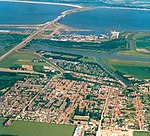
Westvoorne
Former municipalities of South HollandMunicipalities of the Netherlands disestablished in 2023South Holland geography stubsVoorne aan Zee

Westvoorne is a former municipality on the island of Voorne-Putten in the western Netherlands, in the province of South Holland. The former municipality covered an area of 97.48 km2 (37.64 sq mi) of which 44.30 km2 (17.10 sq mi) was water. It had a population of 14,900 in 2021. The municipality of Westvoorne was formed on 1 January 1980, through the merger of the former municipalities of Oostvoorne and Rockanje. It consisted of the population centres of Oostvoorne, Rockanje, Tinte and Helhoek. On 1 January 2023, the municipality of Westvoorne merged with Brielle and Hellevoetsluis into the new municipality of Voorne aan Zee.
Excerpt from the Wikipedia article Westvoorne (License: CC BY-SA 3.0, Authors, Images).Westvoorne
Strandweg, Voorne aan Zee
Geographical coordinates (GPS) Address Nearby Places Show on map
Geographical coordinates (GPS)
| Latitude | Longitude |
|---|---|
| N 51.866666666667 ° | E 4.0666666666667 ° |
Address
Strandweg
Strandweg
3235 EW Voorne aan Zee
South Holland, Netherlands
Open on Google Maps


