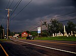
Pleasant Valley School District (Pennsylvania)

Pleasant Valley School District is a mid-sized, rural, public school district in the west end of Monroe County, Pennsylvania in the United States. The district encompasses approximately 114 square miles (300 km2) including: Chestnuthill, Eldred, Polk, and Ross Townships, as well as communities in them, such as Brodheadsville. As of 2000, the school district served a resident population of 29,051. By 2010, the U.S. Census Bureau reported the district's population increased to 33,891 people. In 2009, the district residents' per capita income was $19,853, while the median family income was $51,433. In the Commonwealth, the median family income was $49,501 and the United States median family income was $49,445, in 2010. The educational attainment levels for the school district population (25 years old and over) were 89.5% high school graduates and 17.9% college graduates.
Excerpt from the Wikipedia article Pleasant Valley School District (Pennsylvania) (License: CC BY-SA 3.0, Authors, Images).Pleasant Valley School District (Pennsylvania)
Earl Drive, Chestnuthill Township
Geographical coordinates (GPS) Address Nearby Places Show on map
Geographical coordinates (GPS)
| Latitude | Longitude |
|---|---|
| N 40.9214 ° | E -75.4189 ° |
Address
Earl Drive 263
18322 Chestnuthill Township
Pennsylvania, United States
Open on Google Maps


