Coll de la Font de Cera
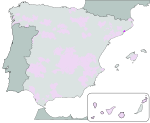
The Coll de la Font de Cera is a mountain pass on the BP-5002 road across the Catalan Coastal Range from El Masnou to Granollers. The pass lies between the municipality of Alella, in the comarca of Maresme, and the municipality of Vallromanes, in the comarca of Vallès Oriental. Both municipalities are in the province of Barcelona, Catalonia, Spain.The pass reaches a height of 274.5 metres (901 ft) above sea level and is in the Parc de la Serralada Litoral.The GR 92 long-distance footpath, which roughly follows the length of the Mediterranean coast of Spain, has a staging point on the pass. Stage 16 links northwards to Coll de Can Bordoi, a distance of 23.0 kilometres (14.3 mi), whilst stage 17 links southwards to Montcada i Reixac, a distance of 16.9 kilometres (10.5 mi).
Excerpt from the Wikipedia article Coll de la Font de Cera (License: CC BY-SA 3.0, Authors).Coll de la Font de Cera
Carretera de Granollers al Masnou,
Geographical coordinates (GPS) Address Nearby Places Show on map
Geographical coordinates (GPS)
| Latitude | Longitude |
|---|---|
| N 41.513954120259 ° | E 2.294136060005 ° |
Address
Carretera de Granollers al Masnou
Carretera de Granollers al Masnou
08328
Catalonia, Spain
Open on Google Maps


