Division of Melbourne Ports

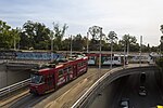
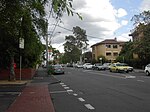
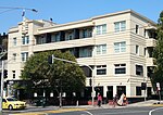
The Division of Melbourne Ports was an Australian federal electoral division in the inner south-eastern suburbs of Melbourne, Victoria, Australia. It was located to the south of Melbourne's central business district and covered an area of approximately 40 km2 around the north and north-eastern shores of Port Phillip Bay. The electorate was created at the time of Australian Federation in 1901 and was one of the original 65 divisions contested at the first federal election. It is named for the fact that at the time of its creation it was centred on Port Melbourne and Williamstown, both major ports. The electorate, formerly working class, was much more demographically diverse on its final boundaries, with rapidly accelerating inner-city gentrification and high-density housing developments in later years. It included Port Melbourne, but also included a number of middle and upper middle class suburbs such as Albert Park, Balaclava, Caulfield, Elwood, Middle Park, Ripponlea, South Melbourne and St Kilda. It was notable for having one of Australia's larger Jewish populations, at 9.9%, much higher than the nationwide 0.4%. It also had a high proportion of atheists and agnostics, with 38.8% of residents answering "No Religion" in the 2016 census, compared to 30.1% nationwide. It also had a large gay and lesbian community.
Excerpt from the Wikipedia article Division of Melbourne Ports (License: CC BY-SA 3.0, Authors, Images).Division of Melbourne Ports
Village Green Drive, Melbourne St Kilda
Geographical coordinates (GPS) Address Nearby Places Show on map
Geographical coordinates (GPS)
| Latitude | Longitude |
|---|---|
| N -37.856 ° | E 144.976 ° |
Address
Harry Trott Oval
Village Green Drive
3182 Melbourne, St Kilda
Victoria, Australia
Open on Google Maps


