place

Junction Oval

1856 establishments in AustraliaCricket grounds in Victoria (Australia)Defunct Australian Football League groundsSports venues completed in 1856Sports venues in Melbourne
Sydney SwansUse Australian English from February 2012Victorian Heritage RegisterWomen's Big Bash League
Junction Oval Victoria V South Australia 30 09 2018 018

Junction Oval (also known as the St Kilda Cricket Ground or the CitiPower Centre due to sponsorship reasons) is a historic sports ground in the suburb of St Kilda in Melbourne, Victoria, Australia.The oval's location near the St Kilda Junction gave rise to its name. It is located approximately five kilometres south from the centre of Melbourne and is in the southernmost part of the large Albert Park sporting precinct. The oval is the administrative headquarters of Cricket Victoria, and was redeveloped between 2015 and 2018 for that purpose.

Excerpt from the Wikipedia article Junction Oval (License: CC BY-SA 3.0, Authors, Images).

Junction Oval
Lakeside Drive, Melbourne St Kilda

Geographical coordinates (GPS) Address External links Nearby Places
placeShow on map

Wikipedia: Junction OvalContinue reading on Wikipedia

Geographical coordinates (GPS)

Latitude Longitude
N -37.855833333333 ° E 144.98 °
placeShow on map

Address

Junction Oval

Lakeside Drive
3182 Melbourne, St Kilda
Victoria, Australia
mapOpen on Google Maps

linkWikiData (Q6311755)
linkOpenStreetMap (733176932)

Junction Oval Victoria V South Australia 30 09 2018 018
Share experience

Nearby Places

Grey Street, Melbourne

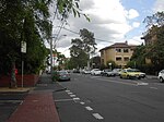
There are 14 Grey Streets in metropolitan Melbourne, but by far the best-known is Grey Street in St Kilda, once a grand residential street but now with a reputation as a centre of prostitution. Grey St was almost certainly named after Sir George Grey, who was Governor of South Australia from 1841 to 1845 and later Prime Minister of New Zealand from 1877 to 1879. St Kilda's official historian, John Butler Cooper, suggests that it may have been named for another Sir George Grey, a British politician, but the fact other nearby streets are also named after colonial governors (Fitzroy St after Charles FitzRoy, Governor of New South Wales, Barkly St after Henry Barkly, Governor of Victoria, and Robe St after Frederick Robe, Grey's successor as Governor of South Australia), makes the first Sir George Grey more likely.Grey Street runs south-east between Fitzroy and Barkly Streets. It lies within the original settlement area of the village of St Kilda, which was subdivided for land sales in 1842. As St Kilda grew into a wealthy and fashionable suburb during the second half of the 19th century, Grey St became lined with the mansions of Melbourne's prosperous mercantile class, attracted by the proximity of St Kilda beach and the hotels and restaurants of Fitzroy St and The Esplanade. One of leading hotels of the era, the George, stands on the corner of Fitzroy and Grey Sts. After decades of decline, it has recently been refurbished and its upper floors converted to apartments. The best-known of Grey Street's great homes was Eildon Mansion, built in 1877 by the wealthy pastoralist John Lang Currie. After many years as a guesthouse, Eildon was bought in 2006 by the Alliance française of Melbourne and has been restored. Next to Eildon is the house where Prime Minister of Australia Stanley Bruce was born in 1883. Other mansions have been converted into apartments or backpackers' hostels. Another well-known landmark on the street in the 19th century was the St Kilda Coffee Palace, now a backpackers' hostel. During the 20th century the social status of St Kilda declined and the wealthy moved away from Grey Street. Since the 1970s it has become notorious as one of Melbourne's main areas of street prostitution. Female prostitutes operate day and night on the corners of Dalgety ("hooker's corner"), Robe and Barkly Streets; and customers in cars, known locally as "gutter crawlers", are regarded by local residents as a major nuisance. Drug use in the area is also regarded as a problem. At night there is a frequent police presence along Grey Street, particularly on weekends. The most prominent landmark on Grey Street is the Sacred Heart Catholic Church, dedicated to the Sacred Heart of Jesus in 1884 by Archbishop James Goold. The Church operates a large welfare centre, the Sacred Heart Mission, near the corner of Grey and Robe Streets, providing meals and sleeping accommodation to the homeless and needy. The Salvation Army operates the St Kilda Crisis Centre on Grey Street, offering services including a needle exchange facility for drug users.

South Yarra Province

South Yarra Province was an electorate of the Victorian Legislative Council from November 1882 until May 1904.South Yarra Province was created in the redistribution of provinces in 1882 when the Central and Eastern Provinces were abolished. The new South Yarra, North Yarra, North Central, South Eastern and Melbourne Provinces were then created. The Legislative Council Act, 1881, created and defined the South Yarra Province as: Commencing at a point on the Yarra river at Princes Bridge; thence south-easterly by the Brighton Road to High street; thence east by that street to the Punt Road; thence north by the last-named road to Yarra river, aforesaid; thence easterly, northerly, and easterly by that river to the north-east angle of allotment 52 parish of Boroondara; thence south by the east boundary of that allotment and by the Burke Road to the Kooyong Koot creek; thence north-westerly by that creek to the Yarra river aforesaid; thence west by that river to the north-east angle of allotment 18 parish of Prahran; thence south by the Kooyong road to the Dandenong Road; thence westerly by that road to Hotham street; thence south by that street to the Brighton Road; thence south-easterly by that road to the Glen Huntly Road; thence west by the last-named road to St. Kilda Street, Elsternwick; thence south by that street to Park Street; thence west by the last named street to the shore of Port Phillip Bay; thence northerly and westerly by the shores of Port Phillip Bay and Hobson's Bay and northerly by the Yarra river to the south boundary of the township of Footscray; thence east and north by the south and part of the east boundaries of that township to the Yarra river aforesaid; thence easterly by that river to the commencing point. South Yarra Province was abolished in another redistribution of Provinces in 1904; new provinces including East Yarra, Melbourne East Province, Melbourne North Province, Melbourne South Province and Melbourne West Provinces were created.