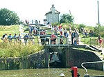
Foxton Inclined Plane
Buildings and structures in LeicestershireCanal inclined planesCanal museums in EnglandCommons category link is locally definedLock flights of England ... and 7 more
Museums in LeicestershireScheduled monuments in LeicestershireStaircase locks of EnglandTourist attractions in LeicestershireTransport in LeicestershireTransport infrastructure completed in 1900Use British English from February 2023

The Foxton Inclined Plane is a canal inclined plane on the Leicester line of the Grand Union Canal about 5 km (3.1 mi) west of the Leicestershire town of Market Harborough, named after the nearby village of Foxton. The plane was built in 1900 as a solution to various operational restrictions imposed by the Foxton Lock flight. However, it was not a commercial success and only remained in full-time operation for ten years. The plane was dismantled in 1926. A project to re-create the plane commenced in the 2000s because the narrowbeam locks remain a bottleneck for leisure boat traffic.
Excerpt from the Wikipedia article Foxton Inclined Plane (License: CC BY-SA 3.0, Authors, Images).Foxton Inclined Plane
Rainbow Bridge, Harborough Foxton
Geographical coordinates (GPS) Address External links Nearby Places Show on map
Geographical coordinates (GPS)
| Latitude | Longitude |
|---|---|
| N 52.5001 ° | E -0.9817 ° |
Address
Foxton Inclined Plane
Rainbow Bridge
LE16 7RA Harborough, Foxton
England, United Kingdom
Open on Google Maps


