Nevada Heights, Spokane
Geography of Spokane, WashingtonNeighborhoods in Spokane, Washington

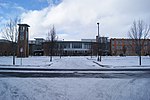
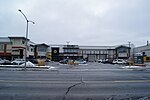
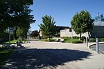
Nevada Heights is a neighborhood in Spokane, Washington, located on the north side of the city. Its southern border is atop a bluff that runs east–west across the north side of the city, which gives the neighborhood its name. Nevada Street, a major north–south arterial, runs through the neighborhood. The neighborhood is largely residential, but also home to large retail districts, medical facilities, schools and parks. Being surrounded by the city of Spokane on all sides, the neighborhood is well integrated into urban area.
Excerpt from the Wikipedia article Nevada Heights, Spokane (License: CC BY-SA 3.0, Authors, Images).Nevada Heights, Spokane
East Wellesley Avenue, Spokane
Geographical coordinates (GPS) Address Nearby Places Show on map
 Continue reading on Wikipedia
 Geographical coordinates (GPS)
| Latitude | Longitude |
|---|---|
| N 47.700638888889 ° | E -117.39511111111 ° |
Address
Taco John's
East Wellesley Avenue
99207 Spokane
Washington, United States
Open on Google Maps