place

Audubon/Downriver, Spokane

Geography of Spokane, WashingtonNeighborhoods in Spokane, Washington
Shadle Water Tower
Shadle Water Tower

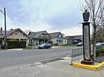
Audubon/Downriver is a neighborhood in Spokane, Washington, located on the northwest side of the city. There is a diversity of land use in the neighborhood, with single-family residential areas dating from the early 20th century through the Post–World War II economic expansion era, regionally important commercial districts, smaller neighborhood retail areas, numerous schools, large parks, a golf course, conservation areas and part of Riverside State Park along the Spokane River. The neighborhood is the site of the corporate offices for Rosauers Supermarkets, a regional grocery store chain with stores located across the Northwestern United States. The neighborhood's name comes from two areas within its bounds, Audubon Park and the Downriver area, so named for being located downriver from Downtown Spokane.

Excerpt from the Wikipedia article Audubon/Downriver, Spokane (License: CC BY-SA 3.0, Authors, Images).

Audubon/Downriver, Spokane
North Driscoll Boulevard, Spokane

Geographical coordinates (GPS) Address Nearby Places
placeShow on map

Wikipedia: Audubon/Downriver, SpokaneContinue reading on Wikipedia

Geographical coordinates (GPS)

Latitude Longitude
N 47.693611111111 ° E -117.45305555556 °
placeShow on map

Address

Driscoll @ Garland

North Driscoll Boulevard
99205 Spokane
Washington, United States
mapOpen on Google Maps

Shadle Water Tower
Shadle Water Tower
Share experience

Nearby Places

Nettleton's Addition Historic District

The Nettleton's Addition Historic District is a historic residential district in the West Central neighborhood of Spokane, Washington. It was listed on the National Register of Historic Places (NRHP) in 2006 because of the concentration of historic homes in one of Spokane's oldest residential neighborhoods and for its significance as an example of community planning and development and in the area of architecture. It is the largest national historic district in the state of Washington. Located on a flat plateau surrounded on three sides by a bend in the Spokane River about a mile-and-a-half northwest of the center of Downtown Spokane, the area's proximity to the city center made it one of the first residential areas developed in Spokane. The neighborhood was platted in 1887 and largely developed by 1911. Architectural styles represented in the district include Queen Anne Revival, shingle style, Colonial Revival, Tudor Revival, Bungalow, American Craftsman, as well as a dozen ranch-style homes which were built after 1937 and are not considered to be contributing properties to the historic district. At the time of its listing on the NRHP in 2006, Nettleton's Addition consisted of 949 properties on 1002 parcels, of which 536 are considered to be historic contributing buildings. Notable architects who worked in the neighborhood include Kirtland Cutter and Karl Malmgren. A working and middle-class neighborhood from the time of its development through to the present day, Nettleton's Addition consists primarily of one-to-two story single-family homes built of wood. Nettleton's Addition was laid out in a grid pattern with sidewalks on every street and alleys running east-to-west in the middle of each block. The only disruptions to this pattern come in the northern and southwestern edges of the district where the terrain drops off dramatically to the river and in one block in the northeastern portion of the district where the Holmes Elementary campus takes up the entire block.