Sulhamstead Lock
Berkshire building and structure stubsLocks of BerkshireLocks on the Kennet and Avon CanalSulhamsteadUse British English from November 2017 ... and 1 more
West Berkshire District

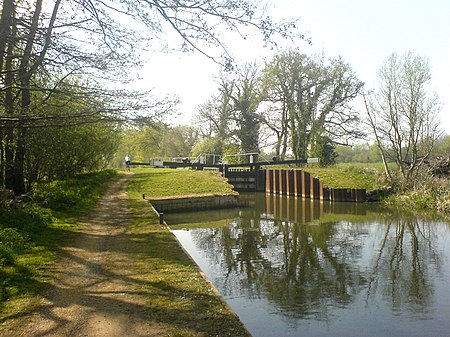
Sulhamstead Lock is a lock on the River Kennet to the east of Sulhamstead in the English county of Berkshire. Sulhamstead Lock was built between 1718 and 1723 under the supervision of the engineer John Hore of Newbury, and this stretch of the river is now administered by the Canal & River Trust as part of the Kennet Navigation. It has a change in level of 4 ft 1 in (1.24 m). The lock is 6 mi 5 furlongs (11 km) from the confluence with the River Thames.The lock was rebuilt in 1966 by a collaboration involving staff from British Waterways and volunteer labour.
Excerpt from the Wikipedia article Sulhamstead Lock (License: CC BY-SA 3.0, Authors, Images).Sulhamstead Lock
Bottom Lane,
Geographical coordinates (GPS) Address Nearby Places Show on map
Geographical coordinates (GPS)
| Latitude | Longitude |
|---|---|
| N 51.42469 ° | E -1.0848 ° |
Address
Bottom Lane
RG7 4BJ
England, United Kingdom
Open on Google Maps


