place

The Queensway–Humber Bay

AC with 0 elementsEtobicokeNeighbourhoods in Toronto
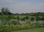
Humber Bay Park November 2012

The Queensway–Humber Bay, known officially as Stonegate–Queensway, is a neighbourhood in the southwest of Toronto, Ontario, Canada. It is located in the southeast area of the former City of Etobicoke.

Excerpt from the Wikipedia article The Queensway–Humber Bay (License: CC BY-SA 3.0, Authors, Images).

The Queensway–Humber Bay
The Queensway, Toronto Etobicoke

Geographical coordinates (GPS) Address Nearby Places
placeShow on map

Wikipedia: The Queensway–Humber BayContinue reading on Wikipedia

Geographical coordinates (GPS)

Latitude Longitude
N 43.630277777778 ° E -79.484166666667 °
placeShow on map

Address

The Queensway 150
M8Y 1J2 Toronto, Etobicoke
Ontario, Canada
mapOpen on Google Maps

Humber Bay Park November 2012
Share experience

Nearby Places

Ontario Food Terminal

The Ontario Food Terminal is the main produce distribution centre for Toronto, Ontario, Canada. It is located at 165 The Queensway at Park Lawn Road, north of the Gardiner Expressway, and west of the Humber River. The U-shaped building occupies 1,740,000 square feet (162,000 m2) of a 40 acres (16 ha) site and includes 80,000 square feet (7,400 m2) of cold storage and is open 24 hours a day, 365 days a year for deliveries. Annually some one million vehicles arrive at the centre delivering produce from across North America or leave to distribute it to stores and restaurants across the city. It is the largest such facility in Canada, and the third largest in North America after those in Chicago and Los Angeles.The Ontario Food Terminal was completed in June 1954 and replaced the Wholesale Fruit Market located west of St. Lawrence Market at The Esplanade. The land had been purchased in 1946 but plans to build on the site were shelved in 1950 due to the scarcity of building materials. It cost $3 million and took two years to build. The architects were Shore and Moffat and Soules Construction Limited built the facility. It included space for 400 trucks. Previously the main distribution centre for Toronto was located in buildings in the five-acre block of King Street East, Market Street, Front Street and Church Street, northwest of the St. Lawrence Market market building. In 1954, it was considered one of the most congested car and truck parking districts in downtown Toronto. Fifty-six wholesale and related firms moved to the new terminal from the old block.When it opened, most shipments arrived by rail with tracks branching off the Canadian National Railway line on the east and south sides of the complex, but the rail tracks have since been removed and today most arrive by truck, while some are flown in via nearby Pearson Airport and delivered via Highway 427 and the Gardiner Expressway. The fruits and vegetables are shipped to the terminal from Ontario farms as well as more distant locales such as Florida, California, and Mexico. At the terminal, local buyers meet the sellers and negotiate prices. It is thus the main market for establishing produce prices in the region. The majority of the produce eaten in Toronto moves through the terminal, though some of the largest grocery store chains such as Loblaws contract directly with growers and do not use it. The Ontario Food Terminal is owned and operated by the Ontario Food Terminal Board, an agency under the Ontario Ministry of Agriculture, Food and Rural Affairs. The Ontario Food Terminal Board leases space in the market to vendors and distribution companies. The board members are appointed by the provincial government, legally through the Lieutenant Governor of Ontario on recommendation from the Minister of Agriculture and Food. The terminal is entirely self-funded from fees charged to the users of the facility. Normally, The Ontario Food Terminal is not open to the public and is a wholesale-only facility. However, on September 22, 2012, it opened its doors for Fresh Fest a community event which offered entertainment, cooking demonstrations, food and informational exhibits. On May 25, 2013, it hosted a second similar event called Taste of the Food Terminal which benefited FoodShare Toronto, a not-for-profit charity organization which focuses on providing healthy food to low-income communities in Toronto.

Grand Harbour (Toronto)

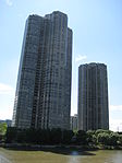
Grand Harbour is a lakefront condominium community in the Etobicoke district of Toronto, Ontario, Canada. It consists of three condominium towers and several dozen townhouses. Grand Harbour is located on the shore of Lake Ontario just west of Humber Bay Park and Mimico Creek. The site was originally home to the Mimico Motor Hotel and the Westpoint Motel and Restaurant, two of the many motels along the Lakeshore strip that became a prominent landmark in the 1950s due to the prominent advertising of the motels competing for travellers on the main highway west of Toronto. Beginning in the 1960s, Highway 401 rose to become the primary east-west route and the motel strip lost business, eventually becoming best known for its somewhat seedy side. In 1988, at the height of a property boom, the prime waterfront real estate was purchased by Rylar Development Ltd for $15.5 million. Larry Boland and Richard Weldon, principals of Rylar, opted to build a set of luxury condominiums designed by Matsui Baer Vanstone. They opted for a distinctly Neo-Eclectic and Postmodern style. Christopher Hume, architecture critic for the Toronto Star, described it as "a hybrid of classical, neo-gothic, and Georgian...mixed together and applied - incongruously but felicitously - to 20th-century-sized structures." Its most striking feature is the 14-storey archway that connects the two tallest towers. Buildings containing a pastiche of historical styles were at their most popular in the late 1980s an early 1990s, but that coincided with a sharp downturn in the Toronto real estate market that saw few buildings erected. Thus the Grand Harbour is one of only a few such condo towers in Toronto from that era. The early 2000s saw more such towers built, but the style had declined as New Modernism became more mainstream. One other example from its era is the Flatiron-shaped 25 The Esplanade, also designed by Matsui Baer Vanstone. The entire project consists of three towers, the tallest being 27 storeys. It is connected by the archway to the shorter 20-storey tower. These buildings contain 276 units, while a third 17-storey tower contains 109 units. At ground level there are 55 townhouses. The original sales went well, and construction began with some 80 per cent of the units sold. However, the recession caused many buyers to abandon the project and the remaining inventory could not be sold. Construction continued, and the complex was completed in 1991. But Rymark was unable to finance the project; banks and court-appointed receivers took control of it in 1994.

Fort Toronto
Fort Toronto

Fort Toronto, also known as Fort Portneuf, was a French trading post that was located near the mouth of the Humber River in what is now Toronto, Ontario, Canada. It was constructed in 1750 by French military officer Pierre Robineau de Portneuf, who had been instructed to build it in order to facilitate trade with First Nations in the Pays d'en Haut region of New France.Fort Toronto was the second French trading post established in the Humber River area. The first one (known as Magasin Royal or Fort Douville) had been built in 1720 by order of the Governor General of New France at that time (Philippe de Rigaud, Marquis de Vaudreuil) near today's Baby Point, about 2 kilometres (1.2 mi) north of the mouth of the Humber River (then known as the Tanaovate River). The French abandoned Magasin Royal by the end of the 1720s, and they did not establish another trading post in the area until the construction of Fort Toronto. Fort Toronto's immediate success in attracting First Nations traders led to the establishment of nearby Fort Rouillé in the following year. These forts existed mainly to facilitate trade between the French and the indigenous peoples. During the Seven Years' War, both forts were abandoned by the French, with Fort Rouillé being razed to prevent its capture by the advancing British forces. Following the war, Fort Toronto was renovated and repurposed as a fur trading post by Jean-Bonaventure Rousseau, after Great Britain captured Quebec City and the entire French colony of New France.

Queen Elizabeth Way Monument

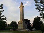
The Queen Elizabeth Way Monument, also known as the Lion Monument and as the Loring Lion, is an Art Deco monument located in Toronto, Ontario, Canada. The 1939–1940 monument honouring Queen Elizabeth was built as a decorative marker monument for the Toronto entrance to the Queen Elizabeth Way (QEW) highway. The stone monument consists of a column with a crown at the top on top of a base. On the face of the base section is a profile of the Queen and a stone lion is placed in front of the base. The monument was designed by architect William Lyon Somerville, who also designed the Henley Bridge of the QEW. Sculptor Frances Loring was commissioned to execute the stone lion. Florence Wyle modelled the royal profiles and crown. Loring started the lion after the entry of Britain and Canada into World War II and it inspired her design: "a snarling, defiant British Lion, eight feet high." Loring personally carved the lion herself from Queenston limestone. She fired her originally commissioned carver after he made unauthorized changes and took over the carving herself in the late summer and fall of 1940. The monument cost CA$23,000 ($393,875 in 2020 dollars)In 1972, the Government of Ontario announced a new expansion to eight lanes of the QEW at the Humber River, necessitating the removal of the monument. It was first proposed to be moved to Ontario Place but the proposed location spawned public criticism. Instead, the monument was moved in August 1975 to nearby Sir Casimir Gzowski Park along Lake Ontario, on the east side of the Humber River. It was re-dedicated in 1989 by Queen Elizabeth, by then styled and known as The Queen Mother. The Queen Elizabeth Way was Ontario's first "super-highway" and it was adorned with decoration, such as its light standards and the Henley Bridge in St. Catharines, Ontario. The bridge is adorned with monuments at each end of the bridge in the area between the two directions of traffic. Each is a galley prow with four regal lions in the boat, each bearing a unique shield. There are also piers at each end, two decorated with sailing ships, a third of a native person and canoe and a fourth of a rower. These were designed by the same team that designed the Lion Monument. These remain in their original location.