Battle Abbey

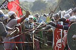
Battle Abbey is a partially ruined Benedictine abbey in Battle, East Sussex, England. The abbey was built on the site of the Battle of Hastings and dedicated to St Martin of Tours. It is a Scheduled Monument.The Grade I listed site is now operated by English Heritage as 1066 Battle of Hastings, Abbey and Battlefield, which includes the abbey buildings and ruins, a visitor centre with a film and exhibition about the battle, audio tours of the battlefield site, and the monks' gatehouse with recovered artefacts. The visitor centre includes a children's discovery room and a café, and there is an outdoor-themed playground. The triple light window depicting the life of St John and the crucifixion of Jesus is claimed to have once adorned Battle Abbey which dates from 1045, removed during the Cromwell era to protect it from destruction. The legend goes that it was hidden for many years until it was transported to Tasmania to be fitted to the eastern end of the Buckland Church.
Excerpt from the Wikipedia article Battle Abbey (License: CC BY-SA 3.0, Authors, Images).Battle Abbey
High Street, Rother Battle
Geographical coordinates (GPS) Address Website External links Nearby Places Show on map
Geographical coordinates (GPS)
| Latitude | Longitude |
|---|---|
| N 50.915 ° | E 0.48583333333333 ° |
Address
Battle Abbey
High Street
TN33 0AD Rother, Battle
England, United Kingdom
Open on Google Maps
