place

Mera (Lake Como)

Commons category link is locally definedGraubünden geography stubsInternational rivers of EuropeItaly river stubsProvince of Sondrio geography stubs
Rivers of GraubündenRivers of ItalyRivers of LombardyRivers of SwitzerlandRivers of the Province of ComoRivers of the Province of SondrioSwitzerland river stubsTributaries of Lake ComoVal Bregaglia
Fiume Mera
Fiume Mera

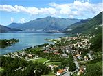
The Mera (Lombard: Maira) is a river in Switzerland and Italy. Its source is near the Piz Mungiroi, in the Grisons, Switzerland. First, it flows east in the direction to Maloja Pass, then turns west through the Val Bregaglia (German: Bergell) and crosses the border to Italy in Castasegna (Dogana). It is joined by the Acquafraggia close to Piuro, and then turns south at Chiavenna, just before it receives the river Liro from the right at Prata Camportaccio. The Mera ends in Lake Como, near Sorico in the Province of Como.

Excerpt from the Wikipedia article Mera (Lake Como) (License: CC BY-SA 3.0, Authors, Images).

Mera (Lake Como)
Piazza Risorgimento,

Geographical coordinates (GPS) Address Nearby Places
placeShow on map

Wikipedia: Mera (Lake Como)Continue reading on Wikipedia

Geographical coordinates (GPS)

Latitude Longitude
N 46.1668 ° E 9.3751 °
placeShow on map

Address

Gera Lario

Piazza Risorgimento
22010
Lombardy, Italy
mapOpen on Google Maps

Fiume Mera
Fiume Mera
Share experience

Nearby Places

Fort Fuentes
Fort Fuentes

Fort Fuentes, Italian: Forte di Fuentes, is a former military fort on the hill of Montecchio or Monteggiolo near Colico, in the province of Lecco, Lombardy, northern Italy. It was built by the Spanish governor of Milan, Don Pedro Enríquez de Acevedo, Count of Fuentes, to command the Pian di Spagna and the strategic Trivio di Fuentes, the crossroads between the Valtellina, the Valchiavenna and the Alto Lario, in order to defend the northern border of the Spanish domain against the Grisons to the north. Construction was begun in 1603 or October 1609 under military architect Gabrio Brusca, and was substantially complete within three years. Ancillary fortified structures were the tower of Sorico, the Torretta del Passo, the Fortino d'Adda, the Torrino di Borgofrancone, the Torretta di Curcio and the tower of Fontanedo. Like the city of Milan, the fort of Fuentes yielded in 1706 to Prince Eugène of Savoy, ending Spanish control of the area. It is thought that the Samolaco horse derives in part from Spanish stock abandoned by the garrisons of these fortifications.The fort was visited in 1769 by the Emperor Joseph II, who declared it militarily useless. It was decommissioned in 1782, and the hill auctioned to a private buyer. The fortress was largely demolished in 1796 by general François Rambeaud on the orders of Napoleon and at the request of the Grisons. During the 19th century the ruins became the refuge of groups of bandits which the Austrian gendarmerie was unable to dislodge. From 1911 until 1913 the Fort Montecchio-Lusardi with eight gun emplacements were constructed on the site, and the circular Spanish tower on the western side demolished at this time. The fort saw no action during the First World War. In 1987 the entire hill, with the ruins of the fort, was acquired by the province of Como, and later passed to the province of Lecco. The Associazione Forte di Fuentes, an association for the protection of the historic site, was formed in 1998.