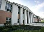
Robbinsville (CDP), New Jersey
Census-designated places in Mercer County, New JerseyCensus-designated places in New JerseyRobbinsville Township, New JerseyUse American English from July 2023Use mdy dates from July 2023

Robbinsville is a census-designated place (CDP) located within Robbinsville Township (known as Washington Township until 2007) in Mercer County, in the U.S. state of New Jersey. The area is served as United States Postal Service ZIP Code 08691. As of the 2010 United States Census, the population for the CDP was 3,041.The CDP includes the area of the township developed as a part of the Robbinsville Town Center. The CDP also includes the largely undeveloped land bordered by the Hamilton Township border, U.S. Route 130, and New Jersey Route 33 though there are some plans to develop this area as well.
Excerpt from the Wikipedia article Robbinsville (CDP), New Jersey (License: CC BY-SA 3.0, Authors, Images).Robbinsville (CDP), New Jersey
Union Street,
Geographical coordinates (GPS) Address Nearby Places Show on map
Geographical coordinates (GPS)
| Latitude | Longitude |
|---|---|
| N 40.219971 ° | E -74.630225 ° |
Address
Union Street
08691
New Jersey, United States
Open on Google Maps


