place

SoMa, Harrisburg, Pennsylvania

Neighborhoods in Harrisburg, Pennsylvania
SoMa Sign Harrisburg

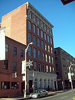
SoMa, or South of Market Street, is a neighborhood in Downtown Harrisburg, Pennsylvania around South Third Street, bounded by Market to the north, 3rd to the west, Chestnut to the south, and 4th to the east. The name "SoMa" derives from the area being "South of Market Street", coined by Harristown Enterprises in 2007 to rebrand the South Third Street area for new development relating to international business and the arts. Eight restored historic buildings became 20 apartments branded as "SoMa on Third". The area is a popular housing area for students attending the nearby Harrisburg University. The area contains popular retail and bar & restaurant destinations and hosts frequent block parties in which they participate with other incoming vendors and entertainment.

Excerpt from the Wikipedia article SoMa, Harrisburg, Pennsylvania (License: CC BY-SA 3.0, Authors, Images).

SoMa, Harrisburg, Pennsylvania
South 3rd Street, Harrisburg

Geographical coordinates (GPS) Address Nearby Places
placeShow on map

Wikipedia: SoMa, Harrisburg, PennsylvaniaContinue reading on Wikipedia

Geographical coordinates (GPS)

Latitude Longitude
N 40.2606 ° E -76.8803 °
placeShow on map

Address

Stash Vintage

South 3rd Street 11
17101 Harrisburg
Pennsylvania, United States
mapOpen on Google Maps

SoMa Sign Harrisburg
Share experience

Nearby Places

Downtown Harrisburg, Pennsylvania

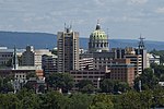
Downtown Harrisburg is the central core neighborhood, business and government center which surrounds the focal point of Market Square, and serves as the regional center for the greater metropolitan area of Harrisburg, Pennsylvania, United States. Harrisburg's downtown Center City comprises the original 80-acre (320,000 m2) borough laid out in a grid pattern by John Harris in 1785. East–west streets are named and north–south streets are numbered. Market Street, running east–west, is the dividing point between north and south street designations.Harrisburg's Central Business District includes the Pennsylvania State Capitol Complex and other state government offices, the Dauphin County Courthouse and other county government offices, City of Harrisburg offices, Pennsylvania State Museum, federal government offices, and other, non-government related commercial retail and office development. Some residential development, both in apartment high-rises and in the upper floors of mixed commercial/residential use buildings, is also located in the downtown area. Downtown is bordered in the northwest by the mixed commercial/residential use Capitol District, in the west by the Susquehanna River, in the southwest by the largely residential Shipoke neighborhood, in the south by Interstate 83, in the east by Amtrak and Norfolk Southern Railway lines, and in the north by Midtown Harrisburg, a mixed-use commercial and residential neighborhood. Forster Street is usually considered the boundary between Downtown and Midtown Harrisburg. City Island, located in the middle of the Susquehanna River directly west of downtown, is typically considered part of Downtown Harrisburg.