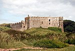
Manorbier
Coast of PembrokeshireCommunities in PembrokeshirePages with Welsh IPAUse British English from April 2021Villages in Pembrokeshire

Manorbier (; Welsh: Maenorbŷr [mɑɨnɔrˈbɨːr]) is a village, community and parish on the south coast of Pembrokeshire, Wales. The name means the 'Manor of Pŷr'. The community includes Jameston, Lydstep and Manorbier Newton. An electoral ward with the same name exists. It stretches inland to St Florence and at the 2011 Census, the population was 2,083. The area is served by the West Wales Line stopping at Manorbier railway station. Manorbier is within the Pembrokeshire Coast National Park and is a popular tourist attraction with Manorbier Castle, St James's Church, the sandy beach, cliffs, and part of the Wales Coast Path.
Excerpt from the Wikipedia article Manorbier (License: CC BY-SA 3.0, Authors, Images).Manorbier
B4585,
Geographical coordinates (GPS) Address Nearby Places Show on map
Geographical coordinates (GPS)
| Latitude | Longitude |
|---|---|
| N 51.6459 ° | E -4.7966 ° |
Address
B4585
SA70 7TD , Manorbier
Wales, United Kingdom
Open on Google Maps


