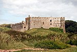
RAF Carew Cheriton
Buildings and structures in PembrokeshireRoyal Air Force stations in WalesRoyal Air Force stations of World War II in the United KingdomRoyal Naval Air Stations in WalesUse British English from May 2013

Royal Air Force Carew Cheriton, or more simply RAF Carew Cheriton, is a former Royal Air Force station located near Carew, Pembrokeshire. It was situated 4.7 miles (7.6 km) north west of Tenby. It covered and more, the same site of the First World War airship station, RNAS Pembroke (aka Milton), which had been decommissioned and sold off by the Admiralty during the Interwar period. It opened in the 1939, for RAF Coastal Command. The station was transferred to RAF Technical Training Command in 1942 and closed in 1945.
Excerpt from the Wikipedia article RAF Carew Cheriton (License: CC BY-SA 3.0, Authors, Images).RAF Carew Cheriton
A477,
Geographical coordinates (GPS) Address Nearby Places Show on map
Geographical coordinates (GPS)
| Latitude | Longitude |
|---|---|
| N 51.689722222222 ° | E -4.8108333333333 ° |
Address
A477
SA70 8AY , Carew
Wales, United Kingdom
Open on Google Maps


