place

Castle Hill, Bronx

Neighborhoods in the Bronx
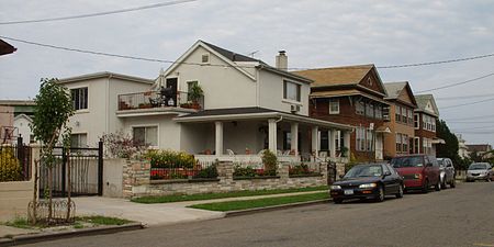
Quimby Avenue Aug26 2007

Castle Hill is a neighborhood located in the southeast section of the borough of the Bronx in New York City. Its boundaries are Waterbury Avenue and Westchester Avenue to the north, Westchester Creek to the east, the East River to the south, and White Plains Road to the west. Unionport is a subsection of Castle Hill, typically considered north of Lafayette Avenue. The neighborhood is part of Bronx Community Board 9. ZIP Codes include 10462, 10472, and 10473. The area is patrolled by the NYPD's 43rd Precinct. New York City Housing Authority (NYCHA) property in the area is patrolled by P.S.A. 8 at 2794 Randall Avenue.

Excerpt from the Wikipedia article Castle Hill, Bronx (License: CC BY-SA 3.0, Authors, Images).

Castle Hill, Bronx
Randall Avenue, New York The Bronx

Geographical coordinates (GPS) Address Nearby Places
placeShow on map

Wikipedia: Castle Hill, BronxContinue reading on Wikipedia

Geographical coordinates (GPS)

Latitude Longitude
N 40.819 ° E -73.85 °
placeShow on map

Address

Randall Avenue 2125
10473 New York, The Bronx
New York, United States
mapOpen on Google Maps

Quimby Avenue Aug26 2007
Share experience

Nearby Places

Westchester Creek
Westchester Creek

Westchester Creek (also known as Frenchman's Creek) is a tidal inlet of the East River located in the south eastern portion of the Bronx in New York City. It is 2.1 miles (3.39 km) in length. The creek formerly traveled further inland, to what is now Pelham Parkway, extending almost to Eastchester Bay and making Throggs Neck into an island during heavy storms. However, much of the route has been filled in, replaced by such structures as the New York City Subway's Westchester Yard and the Hutchinson Metro Center. Westchester Creek's present-day head is at Herbert H. Lehman High School; the remaining portion is largely inaccessible and surrounded by industrial enterprises or empty lots. Westchester Creek is traversed by the Bruckner Interchange at about its midpoint.Pugsley Creek, historically known as Maenippis Kill and Cromwell's Creek, is a right bank tributary of Westchester Creek and is surrounded by a park of the same name. The creek formerly extended north to Westchester Avenue, but was later truncated to Bruckner Expressway and then to its current terminus at Lacombe Avenue. Most of the former creekbed has been developed, though a single block of Bolton Avenue on the creek's path remains undeveloped.Ferry Point Park is on the east bank.The first permanent European settlement in the Bronx, Westchester Square, was established in 1654 by Thomas Pell and 15-20 settlers at the head of navigation of Westchester Creek. The creek's original headwaters was buried in the 1930s to make way for the construction of the Hutchinson River Parkway. A 30-slip marina called Metro Marine was built on the creek in 1957. The creek has become polluted over the years due to heavy industrial use. However, in 2014, the Friends of Ferry Point Park announced plans to restore Westchester and Pugsley Creeks for $100 million.