Aulneuse River
Geographic coordinate listsLists of coordinatesLotbinière Regional County MunicipalityLévis, QuebecRivers of Chaudière-Appalaches ... and 1 more
Use Canadian English from January 2023
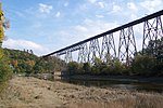
The Aulneuse River (French: rivière Aulneuse) is a tributary of the south shore of the St. Lawrence River. This river flows through the municipalities of Saint-Apollinaire and the town of Lévis (Saint-Nicolas sector), in the administrative region of Chaudière-Appalaches, in Quebec, in Canada.
Excerpt from the Wikipedia article Aulneuse River (License: CC BY-SA 3.0, Authors).Aulneuse River
Rue du Moulin-Ross, Lévis Saint-Nicolas (Les Chutes-de-la-Chaudière-Ouest)
Geographical coordinates (GPS) Address Nearby Places Show on map
 Continue reading on Wikipedia
 Geographical coordinates (GPS)
| Latitude | Longitude |
|---|---|
| N 46.70889 ° | E -71.38222 ° |
Address
Rue du Moulin-Ross
G7A 2N3 Lévis, Saint-Nicolas (Les Chutes-de-la-Chaudière-Ouest)
Quebec, Canada
Open on Google Maps