place

Durrington Walls

Archaeological sites in WiltshireBuildings and structures completed in the 24th century BCFormer populated places in WiltshireHengesSites associated with Stonehenge
Stone Age sites in WiltshireUse British English from September 2013
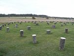
Southern Wall of Durrington Walls

Durrington Walls is the site of a large Neolithic settlement and later henge enclosure located in the Stonehenge World Heritage Site in England. It lies 2 miles (3.2 km) north-east of Stonehenge in the parish of Durrington, just north of Amesbury in Wiltshire. The henge is the second-largest Late Neolithic palisaded enclosure known in the United Kingdom, after Hindwell in Wales.Between 2004 and 2006, excavations on the site by a team led by the University of Sheffield revealed seven houses. It has been suggested that the settlement may have originally had up to 1,000 houses and perhaps 4,000 people, if the entire enclosed area was used. The site was settled for about 500 years, starting sometime between c. 2800 and 2100 BC.The site may have been the largest settlement in northern Europe for a brief period. From 2010 to 2014, a combination of new technology and excavations revealed a 500-metre-diameter (1,600 ft) henge constructed largely of wooden posts. Evidence suggests that this complex was a complementary monument to Stonehenge.In 2020, a geophysical survey uncovered a number of pits, some natural sink holes and others apparently modified to hold massive timbers, interpreted as belonging to a 1.2-mile-wide (1.9 km) circle or circuit of 10-metre (33 ft) pits of Neolithic age. If this interpretation is correct, this would be Britain's largest prehistoric monument.

Excerpt from the Wikipedia article Durrington Walls (License: CC BY-SA 3.0, Authors, Images).

Geographical coordinates (GPS)

Latitude Longitude
N 51.1925 ° E -1.7875 °
placeShow on map

Address

Durrington Walls

Wells Close
SP4 8LY , Durrington
England, United Kingdom
mapOpen on Google Maps

linkWikiData (Q471738)
linkOpenStreetMap (527357301)

Southern Wall of Durrington Walls
Share experience

Nearby Places

Blick Mead
Blick Mead

Blick Mead is a chalkland spring in Wiltshire, England, separated by the River Avon from the northwest edge of the town of Amesbury. It is close to an Iron Age hillfort known as Vespasian's Camp and about a mile east of the Stonehenge ancient monument. Evidence from archaeology excavation at the site since 2005 indicates that there was continuous human habitation from 10,000 BP (8,000 BCE) to 6,000 BP (4,000 BCE). 35,000 worked flints and 2400 animal bones, some cooked, mostly from aurochsen, have been found at the site. There is also the remains of a pit dwelling. A few finds have been used to radiocarbon date the time of settlement. It is thought that the site would have been an attractive place to camp or dwell, with a spring that never freezes over; the issuing water has a constant temperature of around 11 °C (52 °F). Oxygen isotope analysis of a single canine premolar found at Blick Mead has been interpreted as evidence that people had travelled a long way to get there and that this was associated with its proximity to Stonehenge. However, this is inconclusive as, while the isotope values are not consistent with the dog originating at the site, it represents the only example of a dietary isotope profile for a tooth from the Mesolithic, from any species.A rare algae called Hildenbrandia lives in the spring and causes stones taken from it to turn bright red on exposure to air in a matter of hours. In Mesolithic times this could have given the place a magical significance. Its closeness to Stonehenge has led to theories that it is the attraction that first brought hunters to the area, with the colour-changing stones giving the place a spiritual significance.