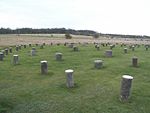
Vespasian's Camp

Vespasian's Camp is an Iron Age hillfort just west of the town of Amesbury, Wiltshire, England. The hillfort is less than 3 kilometres (2 mi) from the Neolithic and Bronze Age site of Stonehenge, and was built on a hill next to the Stonehenge Avenue; it has the River Avon on its southern side and the A303 road on its northern edge. The site is a scheduled monument and lies within the boundaries of the Stonehenge World Heritage Site. Other hillforts nearby include Danebury to the east, Sidbury Hill and Casterley Camp to the north, Yarnbury Castle to the west and Figsbury Ring and Old Sarum to the south. Ogbury Camp, 3 miles (5 km) to the south, may have been a satellite enclosure of Vespasian's Camp.
Excerpt from the Wikipedia article Vespasian's Camp (License: CC BY-SA 3.0, Authors, Images).Vespasian's Camp
Stonehenge Road,
Geographical coordinates (GPS) Address External links Nearby Places Show on map
Geographical coordinates (GPS)
| Latitude | Longitude |
|---|---|
| N 51.174 ° | E -1.793 ° |
Address
Vespasian's Camp
Stonehenge Road
SP4 7BA , Amesbury
England, United Kingdom
Open on Google Maps


