Laleham Burway

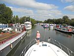
Laleham Burway is a 1.6-square-kilometre (0.62 sq mi) tract of water-meadow and former water-meadow between the River Thames and Abbey River in the far north of Chertsey in Surrey. Its uses are varied. Part is Laleham Golf Club. Semi-permanent park homes in the west forms residential development along with a brief row of houses with gardens against the Thames. A reservoir and water works is on the island. From at least the year 1278 its historic bulky northern definition formed part of the dominant estate of Laleham across the river, its manor, to which it was linked by a ferry until the early 20th century. Its owner in period from the mid-19th until the early 20th century was thus the Earl of Lucan; however when its manor house was sold to become Laleham Abbey, a short-lived nunnery, its tenants had taken it over or it was sold for public works. The southern part of the effective island sharing the name of the Burway or Laleham Burway was the Abbey Mead. It was kept since the seventh century among many square miles of land, priories, chantries, tithes (rectories) and churches of Chertsey Abbey until the Dissolution of the Monasteries. The part legally separate from Abbey Mead (being together a large mill-race island with a broad corollary of the river beside them), the narrower definition comprised 200 acres (81 ha). In 1911 these remained largely for horse and cow pasture. Part of it was a cricket venue in the 18th century and the home of Chertsey Cricket Club.
Excerpt from the Wikipedia article Laleham Burway (License: CC BY-SA 3.0, Authors, Images).Laleham Burway
Monks Walk, Borough of Runnymede
Geographical coordinates (GPS) Address Nearby Places Show on map
Geographical coordinates (GPS)
| Latitude | Longitude |
|---|---|
| N 51.4 ° | E -0.5 ° |
Address
Monks Walk
Monks Walk
KT16 8RN Borough of Runnymede
England, United Kingdom
Open on Google Maps


