Penton Hook Island
Islands of the River ThamesParks and open spaces in SurreyUninhabited islands of EnglandUse British English from January 2017

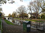
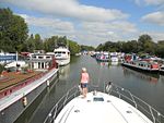
Penton Hook Island is a mainly wooded former peninsula created into a series of three weir-divided islands in the River Thames in England, so created in river modifications since 1815 with a navigable lock and weir stream channel to form meander cutoffs. It has a lock and weirs that are the divide between the Laleham Reach, above Chertsey Lock and Staines Reach, above Penton Hook Lock.
Excerpt from the Wikipedia article Penton Hook Island (License: CC BY-SA 3.0, Authors, Images).Penton Hook Island
Laleham Reach, Borough of Runnymede
Geographical coordinates (GPS) Address Nearby Places Show on map
Geographical coordinates (GPS)
| Latitude | Longitude |
|---|---|
| N 51.411666666667 ° | E -0.50194444444444 ° |
Address
Laleham Reach
KT16 8RT Borough of Runnymede
England, United Kingdom
Open on Google Maps


