Rexdale
Business improvement districts in CanadaEtobicokeNeighbourhoods in Toronto

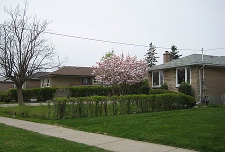
Rexdale is a neighbourhood of Toronto, Ontario, Canada, located north-west of the central core, in the former city of Etobicoke. Rexdale defines an area of several official neighbourhoods north of Highway 401 and east of Highway 427. Rexdale was originally a post World War II residential development within Etobicoke, and today is applied to a general area from Malton and Toronto Pearson International Airport in the City of Mississauga to the west, Highway 401 to the south, Steeles Avenue to the north, and the Humber River to the east. It is centred on Rexdale Boulevard and Islington Avenue.
Excerpt from the Wikipedia article Rexdale (License: CC BY-SA 3.0, Authors, Images).Rexdale
Kipling Avenue, Toronto Etobicoke
Geographical coordinates (GPS) Address Phone number Website Nearby Places Show on map
Geographical coordinates (GPS)
| Latitude | Longitude |
|---|---|
| N 43.721944444444 ° | E -79.571944444444 ° |
Address
Church of St. Paul the Apostle
Kipling Avenue 2182
M9W 4K9 Toronto, Etobicoke
Ontario, Canada
Open on Google Maps


