Hounslow West

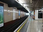
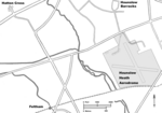
Hounslow West is an area of the London Borough of Hounslow, United Kingdom. It is part of the western residential area of Hounslow but is its own separate area. The area came about with the arrival of the District Railway and then the Piccadilly Line with the opening of what is now Hounslow West tube station and the remodeling of Hounslow Barracks The area is bounded by the River Crane to the west, Cranford and the A30 road to the north and north-west, Hounslow to the east and south-east and Hounslow Heath to the south. Features of the area include Beaversfield Park, Hounslows Heath, Beavers Primary School, St Pauls Church and Hounslow Bowls Club.
Excerpt from the Wikipedia article Hounslow West (License: CC BY-SA 3.0, Authors, Images).Hounslow West
Beavers Lane, London Hounslow West (London Borough of Hounslow)
Geographical coordinates (GPS) Address Nearby Places Show on map
Geographical coordinates (GPS)
| Latitude | Longitude |
|---|---|
| N 51.468445402964 ° | E -0.38885262664087 ° |
Address
Beavers Lane
TW4 6HD London, Hounslow West (London Borough of Hounslow)
England, United Kingdom
Open on Google Maps


