Killcare is a south-eastern suburb of the Central Coast region of New South Wales, Australia, located on the Bouddi Peninsula. It is part of the Central Coast Council local government area.
Prior to the arrival of European Settlement, Aboriginals from the coastal Guringai (Ku-ring-gai) tribe lived in and around Hardys Bay area. Evidence is to be found today in rock carvings and middens found in numerous locations around the area. After British settlement the area was established as a fishing and farming community. The name probably originated later as it was subdivided early last century as "killing one's cares".
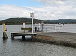
The Killcare area encompasses both the beach and bay side of the Bouddi Peninsula and is flanked by the Bouddi National Park. Killcare retains a small fishing village atmosphere centred on the Killcare Store. The village has an unusually broad variety of shops including yacht charters, art gallery, hairdresser, fashion boutique, restaurant and cafes and real estate agents. Killcare Marina has permanent moorings.
The area has a strong community with many associations including the new Pretty Beach Community Pre-School and Pretty Beach Public School at neighbouring Pretty Beach. The neighbouring suburb Hardys Bay encompasses the south sector of the bay where the Community Church and the Hardys Bay RSL Club are located. The RSL hosts a series of local clubs including the Hardys Bay Hackers Golf Club and the Fridget Digits winter swimmers.
Killcare is also home to the Killcare Rural Fire Service. The volunteer brigade services the surrounding suburbs and the Bouddi National Park, conducting controlled hazard reduction burning and a wide variety of other safety and hazard prevention activities.
Killcare beach is a beautiful south facing beach that looks over to the northern beaches of Sydney. The beach is home to Killcare Surf Lifesaving Club, built in the 1930s, rebuilt in 1973, and then completely demolished and built again in 2009 as a modern state-of-the-art facility, and conducts beach patrols during weekends and public holidays in the summer season. The club has memberships for patrolling adults, children's nippers, youth rookies and associate supporting members. Putty Beach is the Northern end of the beach.


