The Polygon, Southampton
Areas of SouthamptonUse British English from February 2015

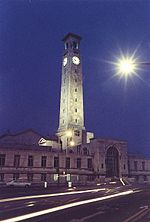
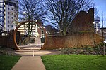
The Polygon (or simply Polygon) is an area in the city of Southampton, England. The area is located north of the Western Esplanade, Commercial Road and Cumberland Place; east of Hill Lane and Rollesbrook Greenway; south of Archers Road; and west of Dorset street and The Avenue (A33). The area notably encompass Watts Park, Southampton Central railway station, Southampton Courts of Justice and the Maritime & Coastguard Agency. The residential area consists of largely Edwardian red brick houses.
Excerpt from the Wikipedia article The Polygon, Southampton (License: CC BY-SA 3.0, Authors, Images).The Polygon, Southampton
The Polygon, Southampton The Polygon
Geographical coordinates (GPS) Address Nearby Places Show on map
Geographical coordinates (GPS)
| Latitude | Longitude |
|---|---|
| N 50.9098 ° | E -1.4092 ° |
Address
Park View Apartments
The Polygon
SO15 2NZ Southampton, The Polygon
England, United Kingdom
Open on Google Maps


