place

Port Richmond, Staten Island

Former villages in New York CityNeighborhoods in Staten Island
Port Richmond from Bayonne

Port Richmond is a neighborhood situated on the North Shore of Staten Island, a borough of New York City. Port Richmond is bounded by Kill van Kull on the north, Jewett Avenue on the east, Forest Avenue on the south, and the Bayonne Bridge on the west. It is adjacent to West New Brighton to the east, Westerleigh to the south, and Elm Park and Mariners Harbor to the west. Formerly an independent village, it is one of the oldest neighborhoods on the island. In the 19th century it was an important transportation and industrial center of the island, but this role has vanished nearly completely, leaving a largely blue collar residential area bypassed by the shift of development of the island to its interior after the 1960s. The formerly bustling commercial center along Richmond Avenue (now Port Richmond Avenue) had been largely abandoned at the time, but many small businesses have opened in the area since the late 20th century. Port Richmond is part of Staten Island Community District 1 and its ZIP Code is 10302. Port Richmond is patrolled by the 121st Precinct of the New York City Police Department.

Excerpt from the Wikipedia article Port Richmond, Staten Island (License: CC BY-SA 3.0, Authors, Images).

Port Richmond, Staten Island
Clove Road, New York Staten Island

Geographical coordinates (GPS) Address Nearby Places
placeShow on map

Wikipedia: Port Richmond, Staten IslandContinue reading on Wikipedia

Geographical coordinates (GPS)

Latitude Longitude
N 40.634 ° E -74.126 °
placeShow on map

Address

Clove Road 243
10310 New York, Staten Island
New York, United States
mapOpen on Google Maps

Port Richmond from Bayonne
Share experience

Nearby Places

Reformed Church on Staten Island

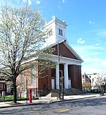
The Reformed Protestant Dutch Church on Staten Island, also known as the Reformed Church on Staten Island (RCSI), is the oldest corporation on Staten Island still engaged in its original enterprise. The Congregation is continuous since 1656. The Church has been on the same spot, in what today is Port Richmond Staten Island, since 1680. The town grew up around the Church, not the other way around. The Archives date to1688. The Burial Place and Baptismal Records date to 1696. The first Church was most likely a barn. The second church, built in 1717, was destroyed by the British during the American Revolutionary War. The third church was built in 1787. The current, and fourth church, was built in 1844 in the Greek Revival style. It is a brick building set on a fieldstone foundation. The front facade features a portico with twin sets of flanking brick pilasters and a central pair of fluted Doric order columns. In 1844 the Congregation reoriented the entrance to what is today Port Richmond Avenue thanks to land donated by Daniel Tompkins, Vice President under James Monroe and founder of Tompkinsville. RCSI Congregants played pivotal roles in American history. The Burial Place has 45 heroes of the wars that created America: The American Revolution, The War of 1812, and The Civil War. One of the Congregation, Cornelius Vanderbilt, amassed one of the world's greatest fortunes and created many laws and procedures that characterize our the modern business world. The 1844 Church and 1696 Burial Place are New York City Landmarks. The site was added to the National Register of Historic Places in 2005 and is a National Historic Site nominee. There is detailed information on the entire history of the Congregation from its role in early Staten Island, through the creation of our nation, to today at olddutchchurchnyc.org. The continuity is extraordinary. Many descendants of the early congregation still live in Port Richmond, on Staten Island, and in neighboring states. Eighty-three Staten Island streets are named for families in the Burial Place. The total rises to 125 streets with the names of families in the Baptismal Book. One current Congregant's family has been with the Reformed Church since 1568 in the Netherlands. In 1730 that same family called the Rev. Cornelis Van Santvoord (1686-1752. RCSI Domini from 1718 to 1740.) to serve their newly formed congregation in Bensalem PA.

Kill Van Kull
Kill Van Kull

The Kill Van Kull is a tidal strait between Staten Island, New York and Bayonne, New Jersey in the United States. It is approximately 3 miles (4.8 km) long and 1,000 feet (305 m) wide and connects Newark Bay with Upper New York Bay. The Robbins Reef Light marks the eastern end of the Kill, Bergen Point its western end. It is spanned by the Bayonne Bridge and is one of the most heavily traveled waterways in the Port of New York and New Jersey. Historically, it has been one of the most important channels for the commerce of the region, providing a passage for marine traffic between Upper New York Bay and the industrial towns of northeastern New Jersey. During the colonial era, it played a significant role in travel between New York and the southern colonies, with passengers changing from ferries to coaches at Elizabethtown (now Elizabeth). Since the final third of the 20th century, it has provided the principal access for oceangoing container ships to Port Newark-Elizabeth Marine Terminal, the busiest port facility in the eastern United States, and Howland Hook Marine Terminal. The strait has required continued dredging and deepening to accommodate the passage of ever-larger ships. In many areas, the sandy bottom has been excavated down to rock and required blasting. The Bayonne Bridge's deck was raised in 2017 so that New Panamax ships could travel the Kill Van Kull.Collins Park in Bayonne is situated along the northern shore.

Elm Park, Staten Island

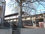
Elm Park is the name of a small park in the Port Richmond section of Staten Island, one of the five boroughs of New York City, United States. The park is located across Innis Street from Port Richmond High School. The name "Elm Park" is sometimes used to denote the area from its namesake westward for several blocks, lending its name to the former Elm Park Station on the North Shore Branch of the Staten Island Railway. The station was situated directly beneath Morningstar Road. Passenger service on this branch of the railway was halted in 1953; a dilapidated remnant of the station's platform still exists, but the stairways leading to the street have been removed. At various times, the neighborhood was known as Jacksonville (c. 1830) and Lowville (c. 1850). Its present name was given to it by a local physician, Dr. John T. Harrison, and refers to the elm trees that could be found on the doctor's estate. The last exit on New York State Route 440 before the Bayonne Bridge is in Elm Park, which also contains one of two Catholic cemeteries on Staten Island named St. Mary's Cemetery; the other cemetery, located in Grasmere, is much larger than the Elm Park cemetery. This often causes confusion. In 2008 Senator Charles Schumer and other Staten Island representatives proposed a Park and Ride under the bridge, for users of bus service to Bayonne, New Jersey. Residents have been opposed to this move, yet local businesses, according to the Staten Island Advance, support it.