place

Sacred Heart Church (Staten Island)

New York City church stubsReligious organizations established in 1875Roman Catholic churches in Staten IslandStaten Island building and structure stubs
Sacred Heart RCC 981 Castleton Av jeh

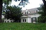
The Church of the Sacred Heart is a Roman Catholic parish church under the authority of the Roman Catholic Archdiocese of New York, located in Staten Island, New York City. The parish was established in 1875. After much financial difficulty, the church building was gradually renovated and extended to cater to the growing congregation and finished in 1900. The affiliated parish elementary school and the Schoenstatt "Shrine of Light" are located across Castleton Avenue.

Excerpt from the Wikipedia article Sacred Heart Church (Staten Island) (License: CC BY-SA 3.0, Authors, Images).

Sacred Heart Church (Staten Island)
Market Street, New York Staten Island

Geographical coordinates (GPS) Address Nearby Places
placeShow on map

Wikipedia: Sacred Heart Church (Staten Island)Continue reading on Wikipedia

Geographical coordinates (GPS)

Latitude Longitude
N 40.635080555556 ° E -74.114911111111 °
placeShow on map

Address

Market Street 170
10310 New York, Staten Island
New York, United States
mapOpen on Google Maps

Sacred Heart RCC 981 Castleton Av jeh
Share experience

Nearby Places

Kill Van Kull
Kill Van Kull

The Kill Van Kull is a tidal strait between Staten Island, New York and Bayonne, New Jersey in the United States. It is approximately 3 miles (4.8 km) long and 1,000 feet (305 m) wide and connects Newark Bay with Upper New York Bay. The Robbins Reef Light marks the eastern end of the Kill, Bergen Point its western end. It is spanned by the Bayonne Bridge and is one of the most heavily traveled waterways in the Port of New York and New Jersey. Historically, it has been one of the most important channels for the commerce of the region, providing a passage for marine traffic between Upper New York Bay and the industrial towns of northeastern New Jersey. During the colonial era, it played a significant role in travel between New York and the southern colonies, with passengers changing from ferries to coaches at Elizabethtown (now Elizabeth). Since the final third of the 20th century, it has provided the principal access for oceangoing container ships to Port Newark-Elizabeth Marine Terminal, the busiest port facility in the eastern United States, and Howland Hook Marine Terminal. The strait has required continued dredging and deepening to accommodate the passage of ever-larger ships. In many areas, the sandy bottom has been excavated down to rock and required blasting. The Bayonne Bridge's deck was raised in 2017 so that New Panamax ships could travel the Kill Van Kull.Collins Park in Bayonne is situated along the northern shore.