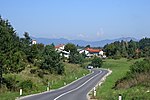
Primož (hill)
Hills of SloveniaMunicipality of Pivka
Primož (pronounced ['pɾiːmɔʃ]) is a 718-meter (2,356 ft) high hill overgrown with trees, and is a part of a ridge separating the Pivka Basin from the Reka Valley. It is located in the Municipality of Pivka in the Inner Carniola region of Slovenia. It has many marked trails and a gravel road leading to its peak. There is a historical trail intended for tourists with many information signs around its peak. It served an important military role during the Second World War because it contained many tunnels and bunkers used by Italian army. It is named after Saints Primus and Felician Church, which was abandoned in the eighteenth century with practically no ruins remaining.
Excerpt from the Wikipedia article Primož (hill) (License: CC BY-SA 3.0, Authors).Primož (hill)
Baterija Primož,
Geographical coordinates (GPS) Address Nearby Places Show on map
Geographical coordinates (GPS)
| Latitude | Longitude |
|---|---|
| N 45.670111111111 ° | E 14.202530555556 ° |
Address
Baterija Primož
Baterija Primož
6257
Slovenia
Open on Google Maps


