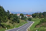
Šilentabor
All accuracy disputesNotranjsko-kraška statistical region geography stubsPages with Slovene IPAPopulated places in the Municipality of Pivka
Šilentabor (pronounced [ˈʃiːlɛntabɔɾ]; in older sources also Tabor, German: Schillertabor) is a small settlement north of Zagorje in the Municipality of Pivka in the Inner Carniola region of Slovenia. It lies on a 751 m high hill called Šilen Tabor, which is a part of Slavniški ravnik, a hill chain that separates the Pivka Basin from the Reka Valley.
Excerpt from the Wikipedia article Šilentabor (License: CC BY-SA 3.0, Authors).Šilentabor
Šilentabor,
Geographical coordinates (GPS) Address Nearby Places Show on map
Geographical coordinates (GPS)
| Latitude | Longitude |
|---|---|
| N 45.648952777778 ° | E 14.208380555556 ° |
Address
Šilentabor
6257
Slovenia
Open on Google Maps


