place

Oakbank Hospital

1904 establishments in Scotland1965 disestablishments in ScotlandDefunct hospitals in ScotlandHospital buildings completed in 1904Hospitals disestablished in 1965
Hospitals established in 1904Hospitals in GlasgowNHS Scotland hospitalsUse British English from January 2020
Western District Hospital at Oakbank

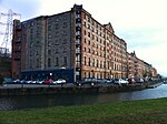
The Oakbank Hospital was a health facility in Possil Road, Glasgow, Scotland.

Excerpt from the Wikipedia article Oakbank Hospital (License: CC BY-SA 3.0, Authors, Images).

Oakbank Hospital
Baird's Brae, Glasgow Oakbank

Geographical coordinates (GPS) Address Nearby Places
placeShow on map

Wikipedia: Oakbank HospitalContinue reading on Wikipedia

Geographical coordinates (GPS)

Latitude Longitude
N 55.8756 ° E -4.2618 °
placeShow on map

Address

Baird's Brae

Baird's Brae
G4 9SQ Glasgow, Oakbank
Scotland, United Kingdom
mapOpen on Google Maps

Western District Hospital at Oakbank
Share experience

Nearby Places

Cowcaddens
Cowcaddens

Cowcaddens (Scots: Coucaddens, Scottish Gaelic: Coille Challtainn) is an area of the city of Glasgow, Scotland. It is very close to the city centre and is bordered by the newer area of Garnethill to the south-west and old Townhead to the east. Cowcaddens was originally a village and became an industrious and thriving part of the expanding Glasgow, being close to Port Dundas and the Forth and Clyde Canal immediately to its north. Its boundaries merged into the City of Glasgow in 1846. By the 1880s, the area was becoming a slum district with the highest level of infant mortality (190 per thousand births) in the city, a figure which was three times that of the West End. Like neighbouring Townhead, Cowcaddens was one of many areas in Glasgow declared a Comprehensive Development Area (CDA) by Glasgow Corporation which led to the mass demolition of the tenement slums, and their replacement with a mixture of lower density housing, commercial and educational zones. The construction of the Glasgow Inner Ring Road in the late 1960s brought huge changes to the northern part of Cowcaddens with major realignment of roads and throughfares. Cowcaddens is served by Cowcaddens subway station on the Glasgow Subway system, and by bus services through it and emanating from Buchanan Bus Station. Glasgow Caledonian University is nearby.The southern fringes of Cowcaddens have historically housed one of Glasgow's premier entertainment districts, with theatres and cinemas dotted throughout the neighbourhood. Notable venues included: the Theatre Royal on Hope Street; The Royalty Theatre on Sauchiehall and Renfield Streets; The Grand Theatre at Cowcaddens Cross; The Scottish Zoo and Hippodrome on New City Road; The Pavilion Theatre on Renfield Street; Green's Playhouse, later the Apollo music hall on Renfrew Street; The Glasgow Film Theatre on Rose Street; The STV headquarters, built in 1974 on Renfield Street. As of 2021, only the Royal, Pavilion, and GFT remain, and the site of the old Apollo is now home to a Cineworld. Since 1988 the Royal Conservatoire of Scotland, formerly RSAMD, has had its main campus on Renfrew Street, with another facility on Garscube Road. The former Cowcaddens Free Church now houses the National Piping Centre. Housing in the area is primarily ex-council housing (there are no council houses in Glasgow since their transfer to the Glasgow Housing Association). In 2007 the Cowcaddens pedestrian underpass was decorated with 15 screen prints by artist Ruth Barker.

A82 road
A82 road

The A82 is a major road in Scotland that runs from Glasgow to Inverness via Fort William. It is one of the principal north-south routes in Scotland and is mostly a trunk road managed by Transport Scotland, who view it as an important link from the Central Belt to the Scottish Highlands and beyond. The road passes close to numerous landmarks, including Loch Lomond, Rannoch Moor, Glen Coe, the Ballachulish Bridge, Ben Nevis, the Commando Memorial, Loch Ness, and Urquhart Castle. The route is derived in several places from the military roads constructed through the Highlands by General George Wade and Major William Caulfeild in the 18th century, along with later roads constructed by Thomas Telford in the 19th. The modern route is based on that designed by Telford, but with a number of improvements primarily dating from the 1920s and 30s. These include a diversion across Rannoch Moor, and another around Loch Leven which was subsequently replaced by the Ballachulish Bridge. Several travel guides have praised individual parts of the road, such as the section from Tyndrum to Glencoe across Rannoch Moor, as providing memorable driving experiences. Tourists find the A82 a popular route because of its scenery, and it serves as a main artery for commercial and heavy goods traffic. Transport Scotland have publicly declared a commitment to improve congestion and safety along the road. Some sections are occasionally closed for maintenance, which has resulted in strong protest from the local community, and the road has been criticised for its poor accident record.