place

Hamiltonhill

Areas of GlasgowGlasgow geography stubsHousing estates in GlasgowUse British English from May 2015

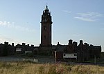
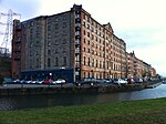
Hamiltonhill is a residential neighbourhood in the Scottish city of Glasgow, situated between Possilpark to the north and east and Port Dundas to the south. To the west of Hamiltonhill is a nature reserve bordering the Forth and Clyde Canal's Glasgow Branch section (with Firhill Stadium on the opposite bank). The neighbourhood falls under the Canal ward of Glasgow City Council. The area consisted primarily of Rehousing (low build quality) grey reconstituted stone tenements from the 1930s. Many of these blocks were refurbished in the 1990s, but by the 2010s almost all had been demolished along with the local schools (St Cuthbert's Primary, which was relocated in 2012 to a new facility in Ruchill Park, closer to parts of the district where new homes had already been built) and Wester Common Primary. Another new school complex for children residing locally, 'Keppoch Campus', was also constructed on the eastern side of Possilpark in the 2000s. Some cottage flats dating from the same period as the tenements were retained, with the result that several clusters of surviving homes in Hamiltonhill were surrounded by expanses of empty waste ground in every direction.In 2018, the local Queens Cross Housing Association published a renewal masterplan for the area involving over 600 new homes.

Excerpt from the Wikipedia article Hamiltonhill (License: CC BY-SA 3.0, Authors).

Hamiltonhill
Dartford Street, Glasgow Hamiltonhill

Geographical coordinates (GPS) Address Nearby Places
placeShow on map

Wikipedia: HamiltonhillContinue reading on Wikipedia

Geographical coordinates (GPS)

Latitude Longitude
N 55.878938 ° E -4.261859 °
placeShow on map

Address

Dartford Street

Dartford Street
G22 5QY Glasgow, Hamiltonhill
Scotland, United Kingdom
mapOpen on Google Maps

Share experience

Nearby Places

A82 road
A82 road

The A82 is a major road in Scotland that runs from Glasgow to Inverness via Fort William. It is one of the principal north-south routes in Scotland and is mostly a trunk road managed by Transport Scotland, who view it as an important link from the Central Belt to the Scottish Highlands and beyond. The road passes close to numerous landmarks, including Loch Lomond, Rannoch Moor, Glen Coe, the Ballachulish Bridge, Ben Nevis, the Commando Memorial, Loch Ness, and Urquhart Castle. The route is derived in several places from the military roads constructed through the Highlands by General George Wade and Major William Caulfeild in the 18th century, along with later roads constructed by Thomas Telford in the 19th. The modern route is based on that designed by Telford, but with a number of improvements primarily dating from the 1920s and 30s. These include a diversion across Rannoch Moor, and another around Loch Leven which was subsequently replaced by the Ballachulish Bridge. Several travel guides have praised individual parts of the road, such as the section from Tyndrum to Glencoe across Rannoch Moor, as providing memorable driving experiences. Tourists find the A82 a popular route because of its scenery, and it serves as a main artery for commercial and heavy goods traffic. Transport Scotland have publicly declared a commitment to improve congestion and safety along the road. Some sections are occasionally closed for maintenance, which has resulted in strong protest from the local community, and the road has been criticised for its poor accident record.